-- Definition --schema for basic types used by multiple themes
Properties
attribute form default
unqualified
element form default
qualified
version
3.3.1
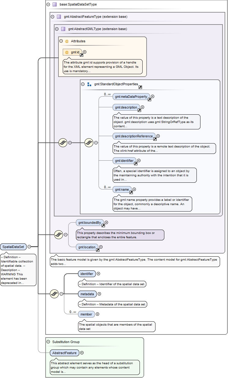
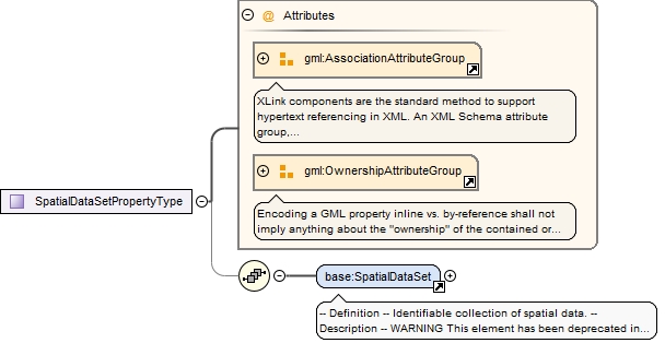
Element base:SpatialDataSet
Namespace
http://inspire.ec.europa.eu/schemas/base/3.3
Annotations
-- Definition --Identifiable collection of spatial data.-- Description --WARNING This element has been deprecated in v3.3.1 of this schema (in accordance with D2.7 v3.3 Recommendation 11 stating that wfs:FeatureCollection should be used instead of base:SpatialDataSet).NOTE The type SpatialDataSet is offered as a pre-defined type for spatial data sets. The scope of this type is packaging pre-defined data sets for the non-direct access download service. It may be reused in thematic application schemas, but if it does not fit an application-schema-specific data set object should be modelled. This type may have the same name and definition like this type, but may have a different set of properties.This type specifies three properties: an external object identifier, a container for metadata (may be void), and an association to zero or more spatial objects.
The attribute gml:id supports provision of a handle for the XML element representing a GML Object. Its use is mandatory for all GML objects. It is of XML type ID, so is constrained to be unique in the XML document within which it occurs.
Source
<element name="SpatialDataSet" type="base:SpatialDataSetType" substitutionGroup="gml:AbstractFeature"><annotation><documentation>-- Definition -- Identifiable collection of spatial data. -- Description -- WARNING This element has been deprecated in v3.3.1 of this schema (in accordance with D2.7 v3.3 Recommendation 11 stating that wfs:FeatureCollection should be used instead of base:SpatialDataSet). NOTE The type SpatialDataSet is offered as a pre-defined type for spatial data sets. The scope of this type is packaging pre-defined data sets for the non-direct access download service. It may be reused in thematic application schemas, but if it does not fit an application-schema-specific data set object should be modelled. This type may have the same name and definition like this type, but may have a different set of properties. This type specifies three properties: an external object identifier, a container for metadata (may be void), and an association to zero or more spatial objects.</documentation></annotation></element>
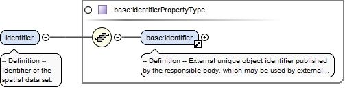
<element name="identifier" type="base:IdentifierPropertyType"><annotation><documentation>-- Definition -- Identifier of the spatial data set.</documentation></annotation></element>
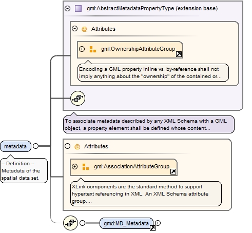
<element name="metadata" nillable="true"><annotation><documentation>-- Definition -- Metadata of the spatial data set.</documentation></annotation><complexType><complexContent><extension base="gml:AbstractMetadataPropertyType"><sequence minOccurs="0"><element ref="gmd:MD_Metadata"/></sequence><attributeGroup ref="gml:AssociationAttributeGroup"/></extension></complexContent></complexType></element>
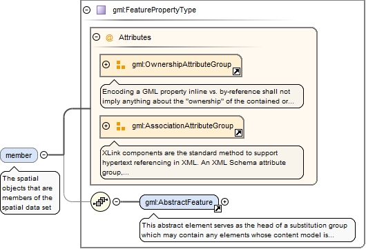
<element name="member" type="gml:FeaturePropertyType" minOccurs="0" maxOccurs="unbounded"><annotation><documentation>The spatial objects that are members of the spatial data set</documentation><appinfo><targetElement xmlns="http://www.opengis.net/gml/3.2">gml:AbstractFeature</targetElement></appinfo></annotation></element>
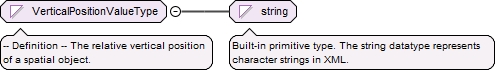
Simple Type base:VerticalPositionValueType
Namespace
http://inspire.ec.europa.eu/schemas/base/3.3
Annotations
-- Definition --The relative vertical position of a spatial object.
Diagram
Type
restriction of string
Facets
enumeration
onGroundSurface
-- Definition --The spatial object is on ground level.
enumeration
suspendedOrElevated
-- Definition --The spatial object is suspended or elevated.
enumeration
underground
-- Definition --The spatial object is underground.
Source
<simpleType name="VerticalPositionValueType"><annotation><documentation>-- Definition -- The relative vertical position of a spatial object.</documentation></annotation><restriction base="string"><enumeration value="onGroundSurface"><annotation><documentation>-- Definition -- The spatial object is on ground level.</documentation></annotation></enumeration><enumeration value="suspendedOrElevated"><annotation><documentation>-- Definition -- The spatial object is suspended or elevated.</documentation></annotation></enumeration><enumeration value="underground"><annotation><documentation>-- Definition -- The spatial object is underground.</documentation></annotation></enumeration></restriction></simpleType>
The attribute gml:id supports provision of a handle for the XML element representing a GML Object. Its use is mandatory for all GML objects. It is of XML type ID, so is constrained to be unique in the XML document within which it occurs.
Source
<complexType name="SpatialDataSetType"><complexContent><extension base="gml:AbstractFeatureType"><sequence><element name="identifier" type="base:IdentifierPropertyType"><annotation><documentation>-- Definition -- Identifier of the spatial data set.</documentation></annotation></element><element name="metadata" nillable="true"><annotation><documentation>-- Definition -- Metadata of the spatial data set.</documentation></annotation><complexType><complexContent><extension base="gml:AbstractMetadataPropertyType"><sequence minOccurs="0"><element ref="gmd:MD_Metadata"/></sequence><attributeGroup ref="gml:AssociationAttributeGroup"/></extension></complexContent></complexType></element><element name="member" type="gml:FeaturePropertyType" minOccurs="0" maxOccurs="unbounded"><annotation><documentation>The spatial objects that are members of the spatial data set</documentation><appinfo><targetElement xmlns="http://www.opengis.net/gml/3.2">gml:AbstractFeature</targetElement></appinfo></annotation></element></sequence></extension></complexContent></complexType>