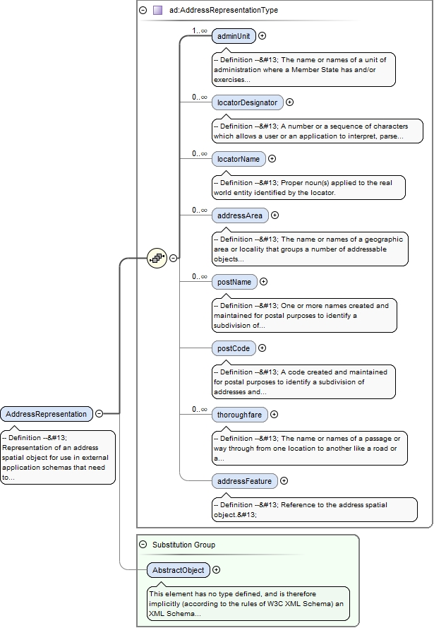
-- Definition --
 Representation of an address spatial object for use in external application schemas that need to include the basic, address information in a readable way.


 -- Description --
 NOTE 1 The data type includes the all necessary readable address components as well as the address locator(s), which allows the identification of the address spatial objects, e.g., country, region, municipality, address area, post code, street name and address number. It also includes an optional reference to the full address spatial object.


 NOTE 2 The datatype could be used in application schemas that wish to include address information e.g. in a dataset that registers buildings or properties.
<element name="AddressRepresentation" type="ad:AddressRepresentationType" substitutionGroup="gml:AbstractObject"><annotation><documentation>-- Definition -- Representation of an address spatial object for use in external application schemas that need to include the basic, address information in a readable way. -- Description -- NOTE 1 The data type includes the all necessary readable address components as well as the address locator(s), which allows the identification of the address spatial objects, e.g., country, region, municipality, address area, post code, street name and address number. It also includes an optional reference to the full address spatial object. NOTE 2 The datatype could be used in application schemas that wish to include address information e.g. in a dataset that registers buildings or properties.</documentation></annotation></element>
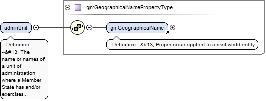
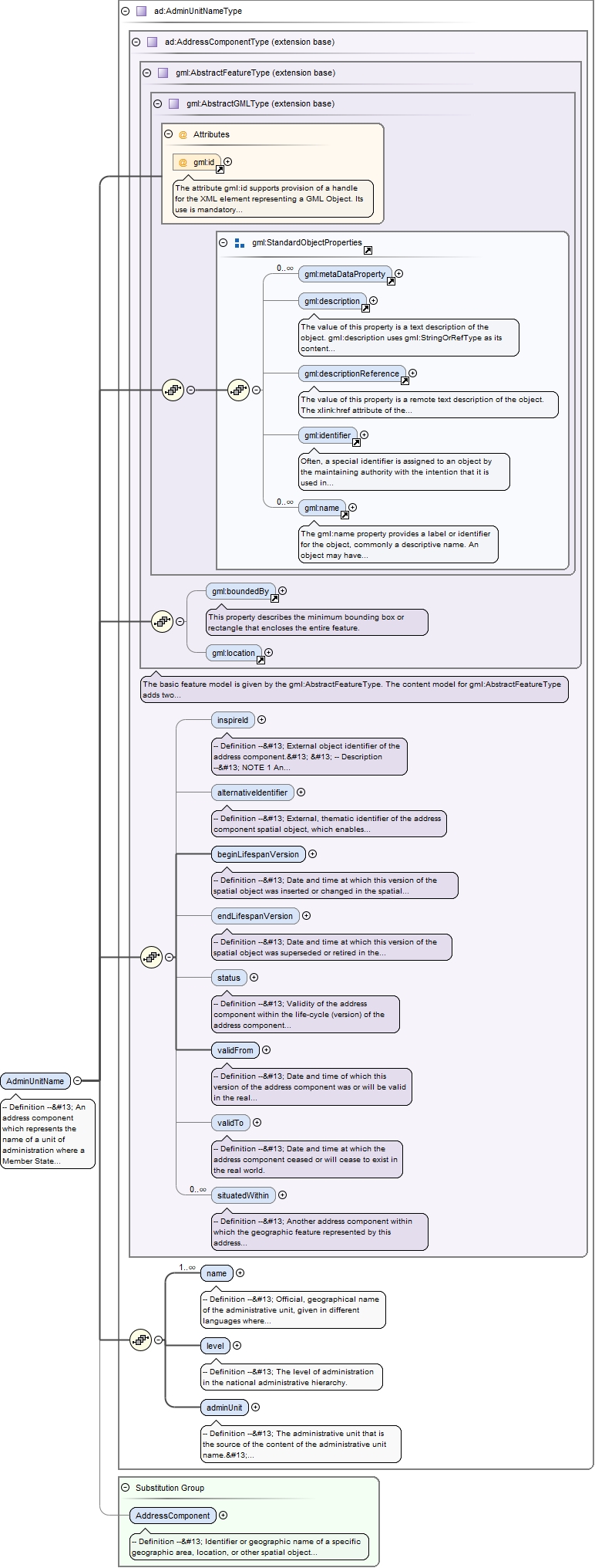
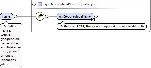
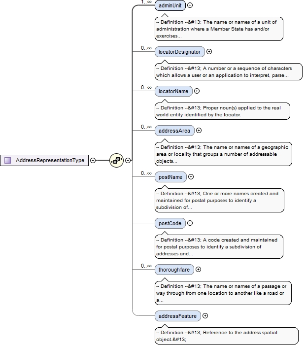
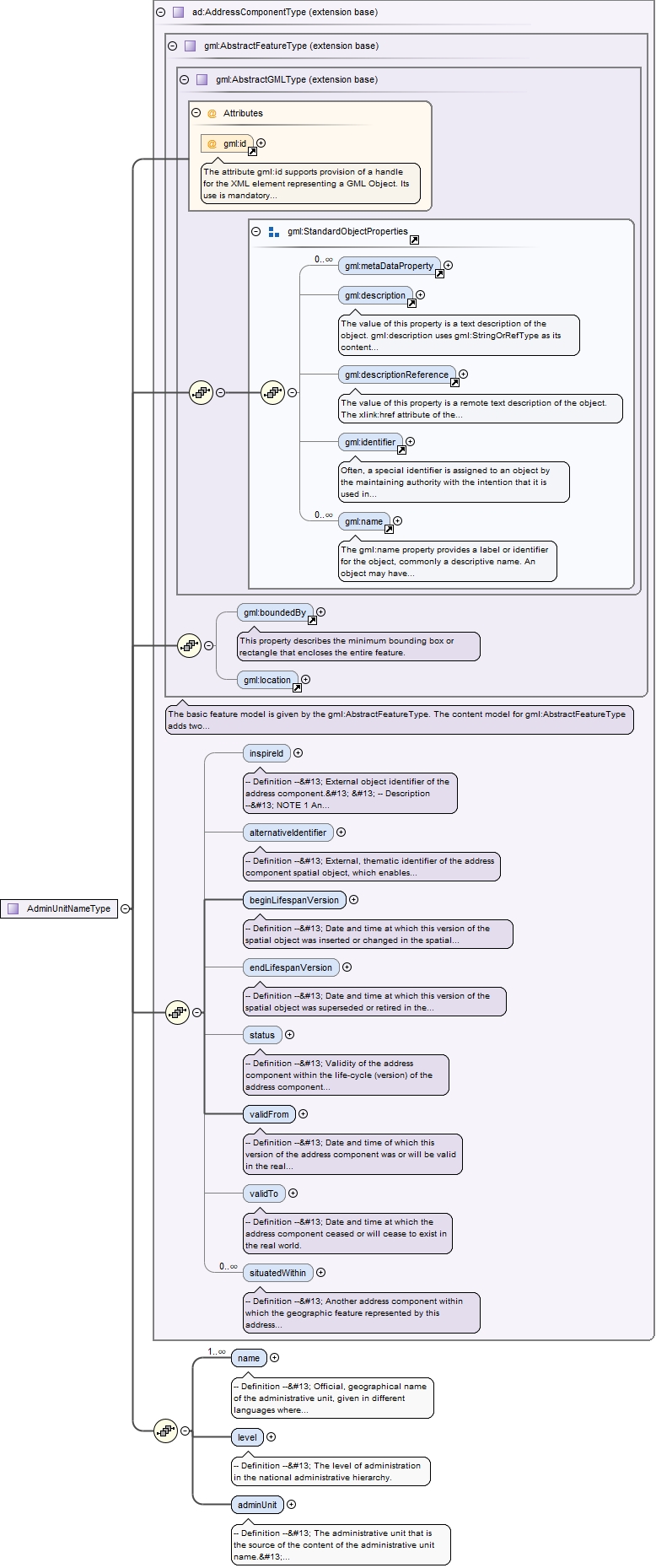
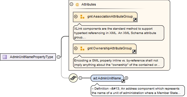
-- Definition --
 The name or names of a unit of administration where a Member State has and/or exercises jurisdictional rights, for local, regional and national governance.
<element name="adminUnit" type="gn:GeographicalNamePropertyType" maxOccurs="unbounded"><annotation><documentation>-- Definition -- The name or names of a unit of administration where a Member State has and/or exercises jurisdictional rights, for local, regional and national governance.</documentation></annotation></element>
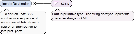
-- Definition --
 A number or a sequence of characters which allows a user or an application to interpret, parse and format the locator within the relevant scope. A locator may include more locator designators.
Diagram
Type
string
Properties
content
simple
minOccurs
0
maxOccurs
unbounded
Source
<element name="locatorDesignator" type="string" minOccurs="0" maxOccurs="unbounded"><annotation><documentation>-- Definition -- A number or a sequence of characters which allows a user or an application to interpret, parse and format the locator within the relevant scope. A locator may include more locator designators.</documentation></annotation></element>
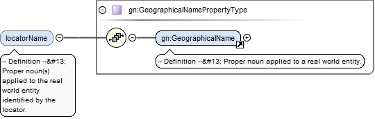
<element name="locatorName" type="gn:GeographicalNamePropertyType" minOccurs="0" maxOccurs="unbounded"><annotation><documentation>-- Definition -- Proper noun(s) applied to the real world entity identified by the locator.</documentation></annotation></element>
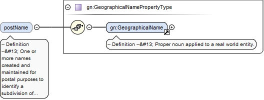
-- Definition --
 The name or names of a geographic area or locality that groups a number of addressable objects for addressing purposes, without being an administrative unit.
<element name="addressArea" nillable="true" minOccurs="0" maxOccurs="unbounded"><annotation><documentation>-- Definition -- The name or names of a geographic area or locality that groups a number of addressable objects for addressing purposes, without being an administrative unit.</documentation></annotation><complexType><sequence><element ref="gn:GeographicalName"/></sequence><attribute name="nilReason" type="gml:NilReasonType"/></complexType></element>
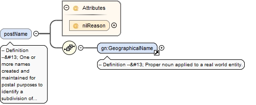
<element name="postName" nillable="true" minOccurs="0" maxOccurs="unbounded"><annotation><documentation>-- Definition -- One or more names created and maintained for postal purposes to identify a subdivision of addresses and postal delivery points.</documentation></annotation><complexType><sequence><element ref="gn:GeographicalName"/></sequence><attribute name="nilReason" type="gml:NilReasonType"/></complexType></element>
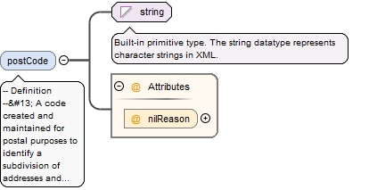
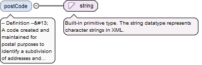
<element name="postCode" nillable="true" minOccurs="0"><annotation><documentation>-- Definition -- A code created and maintained for postal purposes to identify a subdivision of addresses and postal delivery points.</documentation></annotation><complexType><simpleContent><extension base="string"><attribute name="nilReason" type="gml:NilReasonType"/></extension></simpleContent></complexType></element>
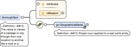
<element name="thoroughfare" nillable="true" minOccurs="0" maxOccurs="unbounded"><annotation><documentation>-- Definition -- The name or names of a passage or way through from one location to another like a road or a waterway.</documentation></annotation><complexType><sequence><element ref="gn:GeographicalName"/></sequence><attribute name="nilReason" type="gml:NilReasonType"/></complexType></element>
<element name="addressFeature" type="gml:ReferenceType" nillable="true" minOccurs="0"><annotation><documentation>-- Definition -- Reference to the address spatial object. </documentation><appinfo><targetElement xmlns="http://www.opengis.net/gml/3.2">ad:Address</targetElement></appinfo></annotation></element>
Element ad:Address
Namespace
urn:x-inspire:specification:gmlas:Addresses:3.0
Annotations
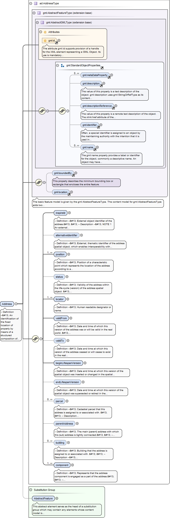
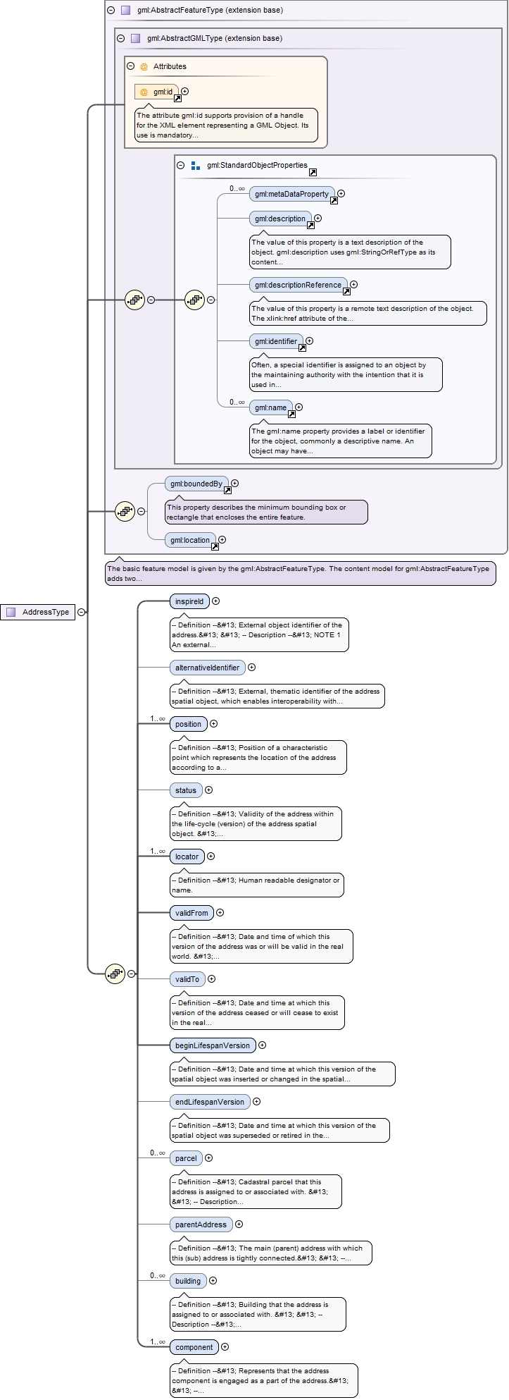
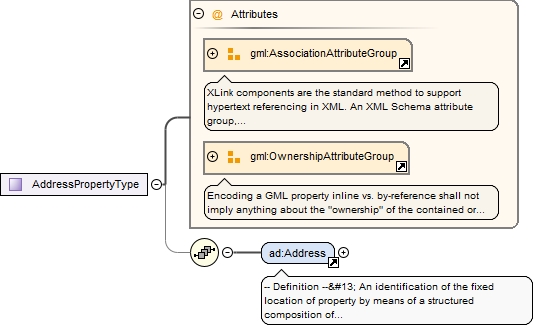
-- Definition -- An identification of the fixed location of property by means of a structured composition of geographic names and identifiers. -- Description -- NOTE 1 The spatial object, referenced by the address, is defined as the "addressable object". The addressable object is not within the application schema, but it is possible to represent the address' reference to a cadastral parcel or a building through associations. It should, however, be noted that in different countries and regions, different traditions and/or regulations determine which object types should be regarded as addressable objects. NOTE 2 In most situations the addressable objects are current, real world objects. However, addresses may also reference objects which are planned, under construction or even historical. NOTE 3 Apart from the identification of the addressable objects (like e.g. buildings), addresses are very often used by a large number of other applications to identify object types e.g. statistics of the citizens living in the building, for taxation of the business entities that occupy the building, and the utility installations. NOTE 4 For different purposes, the identification of an address can be represented in different ways (see example 3). EXAMPLE 1 A property can e.g., be a plot of land, building, part of building, way of access or other construction, EXAMPLE 2 In the Netherlands the primary addressable objects are buildings and dwellings which may include parts of buildings, mooring places or places for the permanent placement of trailers (mobile homes), in the UK it is the lowest level of unit for the delivery of services, in the Czech Republic it is buildings and entrance doors. EXAMPLE 3 Addresses can be represented differently. In a human readable form an address in Spain and an address in Denmark could be represented like this: "Calle Mayor, 13, Cortijo del Marqués, 41037 Écija, Sevilla, España" or "Wildersgade 60A, st. th, 1408 Copenhagen K., Denmark".
The attribute gml:id supports provision of a handle for the XML element representing a GML Object. Its use is mandatory for all GML objects. It is of XML type ID, so is constrained to be unique in the XML document within which it occurs.
Source
<element name="Address" type="ad:AddressType" substitutionGroup="gml:AbstractFeature"><annotation><documentation>-- Definition -- An identification of the fixed location of property by means of a structured composition of geographic names and identifiers. -- Description -- NOTE 1 The spatial object, referenced by the address, is defined as the "addressable object". The addressable object is not within the application schema, but it is possible to represent the address' reference to a cadastral parcel or a building through associations. It should, however, be noted that in different countries and regions, different traditions and/or regulations determine which object types should be regarded as addressable objects. NOTE 2 In most situations the addressable objects are current, real world objects. However, addresses may also reference objects which are planned, under construction or even historical. NOTE 3 Apart from the identification of the addressable objects (like e.g. buildings), addresses are very often used by a large number of other applications to identify object types e.g. statistics of the citizens living in the building, for taxation of the business entities that occupy the building, and the utility installations. NOTE 4 For different purposes, the identification of an address can be represented in different ways (see example 3). EXAMPLE 1 A property can e.g., be a plot of land, building, part of building, way of access or other construction, EXAMPLE 2 In the Netherlands the primary addressable objects are buildings and dwellings which may include parts of buildings, mooring places or places for the permanent placement of trailers (mobile homes), in the UK it is the lowest level of unit for the delivery of services, in the Czech Republic it is buildings and entrance doors. EXAMPLE 3 Addresses can be represented differently. In a human readable form an address in Spain and an address in Denmark could be represented like this: "Calle Mayor, 13, Cortijo del Marqués, 41037 Écija, Sevilla, España" or "Wildersgade 60A, st. th, 1408 Copenhagen K., Denmark".</documentation></annotation></element>
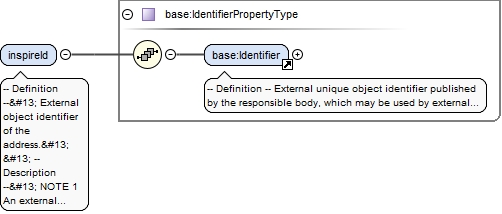
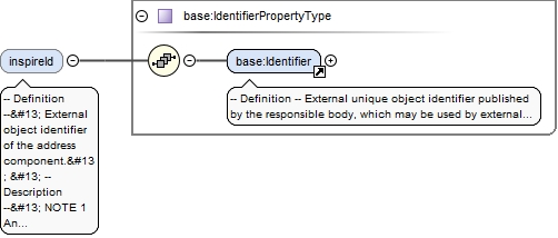
-- Definition -- External object identifier of the address. -- Description -- NOTE 1 An external object identifier is a unique object identifier published by the responsible body, which may be used by external applications to reference the spatial object. The identifier is an identifier of the spatial object, not an identifier of the addressable object. NOTE 2 The primary purpose of this identifier is to enable links between various sources and the address components. EXAMPLE An address spatial object from Denmark could carry this identifier: Namespace: DK_ADR Local identifier: 0A3F507B2AB032B8E0440003BA298018 Version identifier: 12-02-2008T10:05:01+01:00
<element name="inspireId" type="base:IdentifierPropertyType"><annotation><documentation>-- Definition -- External object identifier of the address. -- Description -- NOTE 1 An external object identifier is a unique object identifier published by the responsible body, which may be used by external applications to reference the spatial object. The identifier is an identifier of the spatial object, not an identifier of the addressable object. NOTE 2 The primary purpose of this identifier is to enable links between various sources and the address components. EXAMPLE An address spatial object from Denmark could carry this identifier: Namespace: DK_ADR Local identifier: 0A3F507B2AB032B8E0440003BA298018 Version identifier: 12-02-2008T10:05:01+01:00</documentation></annotation></element>
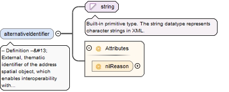
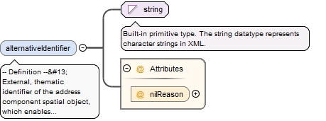
-- Definition -- External, thematic identifier of the address spatial object, which enables interoperability with existing legacy systems or applications. -- Description -- NOTE 1 Compared with the proper identifier of the address, the alternative identifier is not necessarily persistent in the lifetime of the address spatial object. Likewise it is usually not globally unique and in general does not include information on the version of the address spatial object. NOTE 2 Often alternative address identifiers are composed by a set of codes that, e.g., identify the region and the municipality, the thoroughfare name and the address number. These alternative identifiers will not remain persistent e.g. in the case of the merging of two municipalities. EXAMPLE In Denmark many legacy systems (e.g. in the Statistics Denmark or the Central Business Register) uses as address identification the three digit municipality code plus the four character street name code plus the address number.
<element name="alternativeIdentifier" nillable="true" minOccurs="0"><annotation><documentation>-- Definition -- External, thematic identifier of the address spatial object, which enables interoperability with existing legacy systems or applications. -- Description -- NOTE 1 Compared with the proper identifier of the address, the alternative identifier is not necessarily persistent in the lifetime of the address spatial object. Likewise it is usually not globally unique and in general does not include information on the version of the address spatial object. NOTE 2 Often alternative address identifiers are composed by a set of codes that, e.g., identify the region and the municipality, the thoroughfare name and the address number. These alternative identifiers will not remain persistent e.g. in the case of the merging of two municipalities. EXAMPLE In Denmark many legacy systems (e.g. in the Statistics Denmark or the Central Business Register) uses as address identification the three digit municipality code plus the four character street name code plus the address number.</documentation></annotation><complexType><simpleContent><extension base="string"><attribute name="nilReason" type="gml:NilReasonType"/></extension></simpleContent></complexType></element>
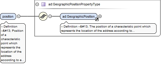
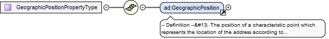
-- Definition -- Position of a characteristic point which represents the location of the address according to a certain specification, including information on the origin of the position.
<element name="position" type="ad:GeographicPositionPropertyType" maxOccurs="unbounded"><annotation><documentation>-- Definition -- Position of a characteristic point which represents the location of the address according to a certain specification, including information on the origin of the position.</documentation></annotation></element>
Element ad:GeographicPosition
Namespace
urn:x-inspire:specification:gmlas:Addresses:3.0
Annotations
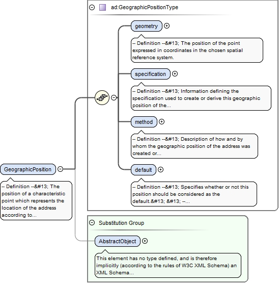
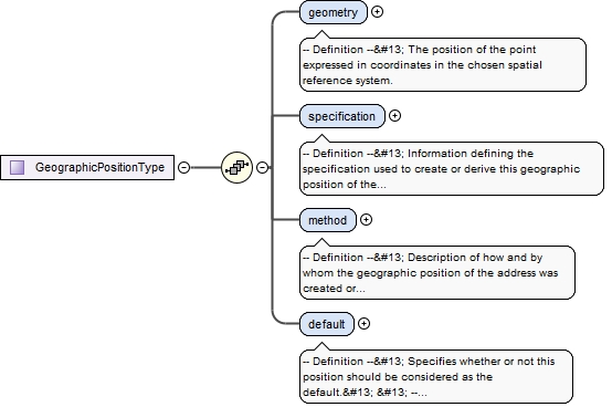
-- Definition -- The position of a characteristic point which represents the location of the address according to a certain specification, including information on the origin of the position.
<element name="GeographicPosition" type="ad:GeographicPositionType" substitutionGroup="gml:AbstractObject"><annotation><documentation>-- Definition -- The position of a characteristic point which represents the location of the address according to a certain specification, including information on the origin of the position.</documentation></annotation></element>
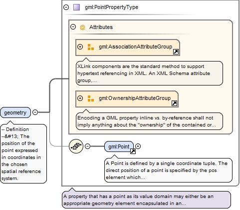
<element name="geometry" type="gml:PointPropertyType"><annotation><documentation>-- Definition -- The position of the point expressed in coordinates in the chosen spatial reference system.</documentation></annotation></element>
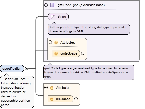
<element name="specification" nillable="true"><annotation><documentation>-- Definition -- Information defining the specification used to create or derive this geographic position of the address.</documentation></annotation><complexType><simpleContent><extension base="gml:CodeType"><attribute name="nilReason" type="gml:NilReasonType"/></extension></simpleContent></complexType></element>
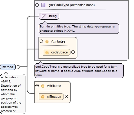
-- Definition -- Description of how and by whom the geographic position of the address was created or derived. -- Description -- NOTE The geographic position could be created manually by the address authority itself, by an independent party (e.g. by field surveying or digitizing of paper maps) or it could be derived automatically from the addressable object or from other Inspire features.
<element name="method" nillable="true"><annotation><documentation>-- Definition -- Description of how and by whom the geographic position of the address was created or derived. -- Description -- NOTE The geographic position could be created manually by the address authority itself, by an independent party (e.g. by field surveying or digitizing of paper maps) or it could be derived automatically from the addressable object or from other Inspire features.</documentation></annotation><complexType><simpleContent><extension base="gml:CodeType"><attribute name="nilReason" type="gml:NilReasonType"/></extension></simpleContent></complexType></element>
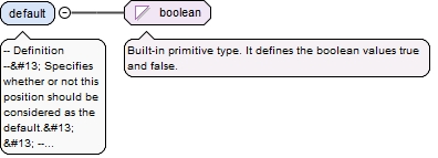
-- Definition -- Specifies whether or not this position should be considered as the default. -- Description -- NOTE As a member state may provide several positions of an address, there is a need to identify the commonly used (main) position. Preferrably, the default position should be the one with best accuracy.
Diagram
Type
boolean
Properties
content
simple
Source
<element name="default" type="boolean"><annotation><documentation>-- Definition -- Specifies whether or not this position should be considered as the default. -- Description -- NOTE As a member state may provide several positions of an address, there is a need to identify the commonly used (main) position. Preferrably, the default position should be the one with best accuracy.</documentation></annotation></element>
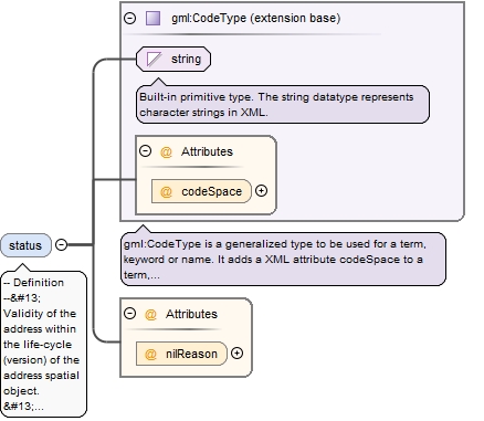
-- Definition -- Validity of the address within the life-cycle (version) of the address spatial object. -- Description -- NOTE This status relates to the address and is not a property of the object to which the address is assigned (the addressable object).
<element name="status" nillable="true" minOccurs="0"><annotation><documentation>-- Definition -- Validity of the address within the life-cycle (version) of the address spatial object. -- Description -- NOTE This status relates to the address and is not a property of the object to which the address is assigned (the addressable object).</documentation></annotation><complexType><simpleContent><extension base="gml:CodeType"><attribute name="nilReason" type="gml:NilReasonType"/></extension></simpleContent></complexType></element>
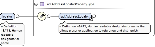
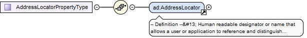
<element name="locator" type="ad:AddressLocatorPropertyType" maxOccurs="unbounded"><annotation><documentation>-- Definition -- Human readable designator or name.</documentation></annotation></element>
Element ad:AddressLocator
Namespace
urn:x-inspire:specification:gmlas:Addresses:3.0
Annotations
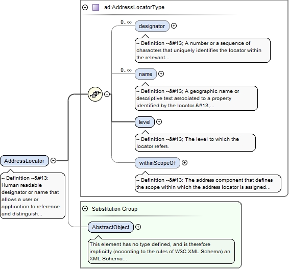
-- Definition -- Human readable designator or name that allows a user or application to reference and distinguish the address from neighbour addresses, within the scope of a thoroughfare name, address area name, administrative unit name or postal designator, in which the address is situated. -- Description -- NOTE 1 The most common locators are designators like an address number, building number or flat identifier as well as the name of the property, complex or building. NOTE 2 The locator identifier(s) are most often only unambiguous and meaningful within the scope of the adjacent thoroughfare name, address area name or post code. NOTE 3 The locator could be composed of one or more designators e.g., address number, address number suffix, building number or name, floor number, flat or room identifier. In addition to these common locator types, also narrative or descriptive locators are possible. NOTE 4 The locators of an address could be composed as a hierarchy, where one level of locators identifies the real property or building while another level of locators identifies the flats or dwellings inside the property. EXAMPLE 1 In a Spanish city a "site-level" locator could identify a building on the thoroughfare name "Calle Gran Vía using the address number "8". If the building has four entrance doors, the door number "3" could be the "access-level" locator. The 3rd door could, via two staircases "A" and "B", give access to a number of floors, identified by a number "1" to "5" on which a number of dwellings are situated, also identified by numbers "1" to "3"; The "unit level" locator will thus composed of staircase-, floor- and dwelling identification e.g. "staircase A, floor 5, dwelling 1". In total, the three parent-child levels of locators uniquely identify the dwelling. EXAMPLE 2 In Copenhagen an "access level" locator could identify a specific entrance door in a building on the thoroughfare name "Wildersgade" using the address number "60A" (In Denmark the optional suffix is a part of the address number). The entrance door gives access to a number of floors, e.g, "st", "1", "2", "3", on which two dwellings are situated "tv" and "th". The "unit level" locator will thus be composed by a floor- and a door identifier: "2. th." (2nd floor, door to the right). In total, the two parent-child levels of locators uniquely identify the dwelling. EXAMPLE 3 In The Netherlands only one level of locators exists. The individual apartment within a large complex, a dwelling, a part of other kinds of buildings (for example an office), a mooring place or a place for the permanent placing of trailers are addressable objects which must have an address. This address is the only level of the locator. This locator could be composed by three attributes the house number, plus optionally an additional house letter, plus optionally an additional housenumber suffix. EXAMPLE 4 Sometimes the building name is an alternative identifier to the address number e.g. the house located in "Calle Santiago, 15, Elizondo-Baztán, Navarra, Spain" is also identified by the building name "Urtekoetxea"
<element name="AddressLocator" type="ad:AddressLocatorType" substitutionGroup="gml:AbstractObject"><annotation><documentation>-- Definition -- Human readable designator or name that allows a user or application to reference and distinguish the address from neighbour addresses, within the scope of a thoroughfare name, address area name, administrative unit name or postal designator, in which the address is situated. -- Description -- NOTE 1 The most common locators are designators like an address number, building number or flat identifier as well as the name of the property, complex or building. NOTE 2 The locator identifier(s) are most often only unambiguous and meaningful within the scope of the adjacent thoroughfare name, address area name or post code. NOTE 3 The locator could be composed of one or more designators e.g., address number, address number suffix, building number or name, floor number, flat or room identifier. In addition to these common locator types, also narrative or descriptive locators are possible. NOTE 4 The locators of an address could be composed as a hierarchy, where one level of locators identifies the real property or building while another level of locators identifies the flats or dwellings inside the property. EXAMPLE 1 In a Spanish city a "site-level" locator could identify a building on the thoroughfare name "Calle Gran Vía using the address number "8". If the building has four entrance doors, the door number "3" could be the "access-level" locator. The 3rd door could, via two staircases "A" and "B", give access to a number of floors, identified by a number "1" to "5" on which a number of dwellings are situated, also identified by numbers "1" to "3"; The "unit level" locator will thus composed of staircase-, floor- and dwelling identification e.g. "staircase A, floor 5, dwelling 1". In total, the three parent-child levels of locators uniquely identify the dwelling. EXAMPLE 2 In Copenhagen an "access level" locator could identify a specific entrance door in a building on the thoroughfare name "Wildersgade" using the address number "60A" (In Denmark the optional suffix is a part of the address number). The entrance door gives access to a number of floors, e.g, "st", "1", "2", "3", on which two dwellings are situated "tv" and "th". The "unit level" locator will thus be composed by a floor- and a door identifier: "2. th." (2nd floor, door to the right). In total, the two parent-child levels of locators uniquely identify the dwelling. EXAMPLE 3 In The Netherlands only one level of locators exists. The individual apartment within a large complex, a dwelling, a part of other kinds of buildings (for example an office), a mooring place or a place for the permanent placing of trailers are addressable objects which must have an address. This address is the only level of the locator. This locator could be composed by three attributes the house number, plus optionally an additional house letter, plus optionally an additional housenumber suffix. EXAMPLE 4 Sometimes the building name is an alternative identifier to the address number e.g. the house located in "Calle Santiago, 15, Elizondo-Baztán, Navarra, Spain" is also identified by the building name "Urtekoetxea"</documentation></annotation></element>
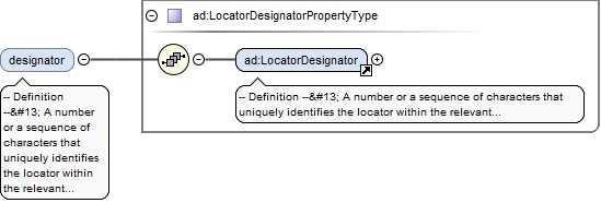
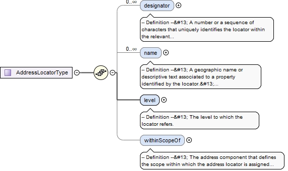
<element name="designator" type="ad:LocatorDesignatorPropertyType" minOccurs="0" maxOccurs="unbounded"><annotation><documentation>-- Definition -- A number or a sequence of characters that uniquely identifies the locator within the relevant scope(s).</documentation></annotation></element>
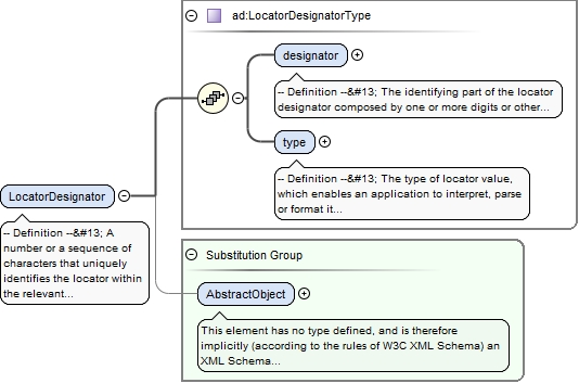
Element ad:LocatorDesignator
Namespace
urn:x-inspire:specification:gmlas:Addresses:3.0
Annotations
-- Definition -- A number or a sequence of characters that uniquely identifies the locator within the relevant scope(s). The full identification of the locator could include one or more locator designators. -- Description -- NOTE 1 Locator designators are often assigned according to a set of commonly known rules which enables a user or application to "parse" the information: Address numbers are most often assigned in ascending order with odd and even numbers on each side of the thoroughfare. In a building, the floor identifier represents the level according to the traditions within the area, e.g., 1, 2, 3. NOTE 2 Several types of locator designators exist, such as: Address number, address number suffix, building identifier, building name. A locator could be composed by an ordered set of these. EXAMPLE In Paris, France a locator could be composed by two locator designators: address number "18" and address number suffix: "BIS".
<element name="LocatorDesignator" type="ad:LocatorDesignatorType" substitutionGroup="gml:AbstractObject"><annotation><documentation>-- Definition -- A number or a sequence of characters that uniquely identifies the locator within the relevant scope(s). The full identification of the locator could include one or more locator designators. -- Description -- NOTE 1 Locator designators are often assigned according to a set of commonly known rules which enables a user or application to "parse" the information: Address numbers are most often assigned in ascending order with odd and even numbers on each side of the thoroughfare. In a building, the floor identifier represents the level according to the traditions within the area, e.g., 1, 2, 3. NOTE 2 Several types of locator designators exist, such as: Address number, address number suffix, building identifier, building name. A locator could be composed by an ordered set of these. EXAMPLE In Paris, France a locator could be composed by two locator designators: address number "18" and address number suffix: "BIS".</documentation></annotation></element>
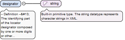
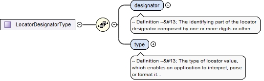
-- Definition -- The identifying part of the locator designator composed by one or more digits or other characters. -- Description -- NOTE The value is often a descriptive code assigned according to certain well known rules e.g. like ascending odd and even address numbers along the thoroughfare, or like floor identifiers: 0, 1, 2, 3. EXAMPLE Address number "2065", Address number suffix "B", Floor identifier "7" door identifier "B707" are all locator attribute values.
Diagram
Type
string
Properties
content
simple
Source
<element name="designator" type="string"><annotation><documentation>-- Definition -- The identifying part of the locator designator composed by one or more digits or other characters. -- Description -- NOTE The value is often a descriptive code assigned according to certain well known rules e.g. like ascending odd and even address numbers along the thoroughfare, or like floor identifiers: 0, 1, 2, 3. EXAMPLE Address number "2065", Address number suffix "B", Floor identifier "7" door identifier "B707" are all locator attribute values.</documentation></annotation></element>
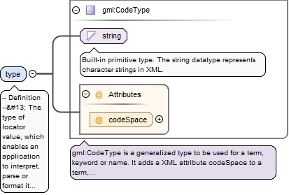
-- Definition -- The type of locator value, which enables an application to interpret, parse or format it according to certain rules. -- Description -- NOTE The type enables a user or an application to understand if the value "A" is e.g. an identifier of a specific building, door, staircase or dwelling.
<element name="type" type="gml:CodeType"><annotation><documentation>-- Definition -- The type of locator value, which enables an application to interpret, parse or format it according to certain rules. -- Description -- NOTE The type enables a user or an application to understand if the value "A" is e.g. an identifier of a specific building, door, staircase or dwelling.</documentation></annotation></element>
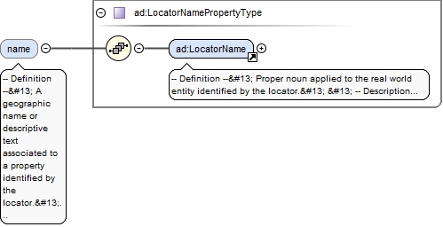
-- Definition -- A geographic name or descriptive text associated to a property identified by the locator. -- Description -- NOTE 1 The locator name could be the name of the property or complex (e.g. an estate, hospital or a shopping mall), of the building or part of the building (e.g. a wing), or it could be the name of a room inside the building. NOTE 2 As locator name it is also possible to use a description that allows a user to identify the property in question. NOTE 3 The locator name could be an alternative addition to the locator designator (e.g. the address number) or it could be an independent identifier. EXAMPLE In the address "Calle Santiago, 15, Elizondo-Baztán, Navarra, Spain" the building name "Urtekoetxea" is an alternative to the building identifier "3".
<element name="name" type="ad:LocatorNamePropertyType" minOccurs="0" maxOccurs="unbounded"><annotation><documentation>-- Definition -- A geographic name or descriptive text associated to a property identified by the locator. -- Description -- NOTE 1 The locator name could be the name of the property or complex (e.g. an estate, hospital or a shopping mall), of the building or part of the building (e.g. a wing), or it could be the name of a room inside the building. NOTE 2 As locator name it is also possible to use a description that allows a user to identify the property in question. NOTE 3 The locator name could be an alternative addition to the locator designator (e.g. the address number) or it could be an independent identifier. EXAMPLE In the address "Calle Santiago, 15, Elizondo-Baztán, Navarra, Spain" the building name "Urtekoetxea" is an alternative to the building identifier "3".</documentation></annotation></element>
Element ad:LocatorName
Namespace
urn:x-inspire:specification:gmlas:Addresses:3.0
Annotations
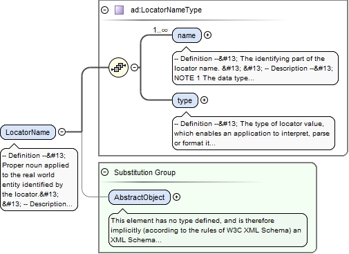
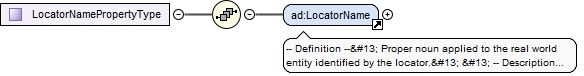
-- Definition -- Proper noun applied to the real world entity identified by the locator. -- Description -- NOTE The locator name could be the name of the property or complex, of the building or part of the building, or it could be the name of a room inside a building.
<element name="LocatorName" type="ad:LocatorNameType" substitutionGroup="gml:AbstractObject"><annotation><documentation>-- Definition -- Proper noun applied to the real world entity identified by the locator. -- Description -- NOTE The locator name could be the name of the property or complex, of the building or part of the building, or it could be the name of a room inside a building.</documentation></annotation></element>
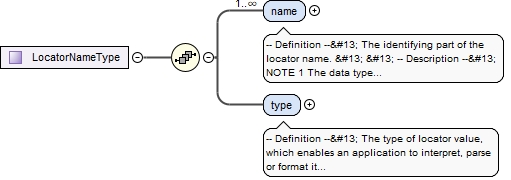
-- Definition -- The identifying part of the locator name. -- Description -- NOTE 1 The data type allows names in different languages and scripts as well as inclusion of alternative name, alternative spellings, historical name and exonyms. NOTE 2 The locator name could be the name of the property or complex, of the building or part of the building (e.g. a wing), or it could be the name of a room or similar inside the building. NOTE 3 The locator name sometimes refer to the name of the family or business entity which at present or in the past has owned or occupied the property or building; although this is the case the locator name must not be confused with the name of the addressee(s). NOTE 4 As locator name it is also possible to use a descriptive text that allows a user to identify the property in question. EXAMPLE 1 The "Radford Mill Farm" in Timsbury, Bath, UK; The allotment house area "Brumleby" in Copenhagen, Denmark, the university campus "Cité Universitaire", in Paris, France. EXAMPLE 2 "Millers House" in Stromness, Orkney Isles, UK; "Ulla's Pension" in Niederfell, Rheinland-Pfalz, Germany. EXAMPLE 3 "Multi-storey car park at Southampton Magistrates Courts" in Southampton, UK.
<element name="name" type="gn:GeographicalNamePropertyType" maxOccurs="unbounded"><annotation><documentation>-- Definition -- The identifying part of the locator name. -- Description -- NOTE 1 The data type allows names in different languages and scripts as well as inclusion of alternative name, alternative spellings, historical name and exonyms. NOTE 2 The locator name could be the name of the property or complex, of the building or part of the building (e.g. a wing), or it could be the name of a room or similar inside the building. NOTE 3 The locator name sometimes refer to the name of the family or business entity which at present or in the past has owned or occupied the property or building; although this is the case the locator name must not be confused with the name of the addressee(s). NOTE 4 As locator name it is also possible to use a descriptive text that allows a user to identify the property in question. EXAMPLE 1 The "Radford Mill Farm" in Timsbury, Bath, UK; The allotment house area "Brumleby" in Copenhagen, Denmark, the university campus "Cité Universitaire", in Paris, France. EXAMPLE 2 "Millers House" in Stromness, Orkney Isles, UK; "Ulla's Pension" in Niederfell, Rheinland-Pfalz, Germany. EXAMPLE 3 "Multi-storey car park at Southampton Magistrates Courts" in Southampton, UK.</documentation></annotation></element>
-- Definition -- The type of locator value, which enables an application to interpret, parse or format it according to certain rules. -- Description -- NOTE The type enables a user or an application to understand if the name "Radford Mill Farm" is for example a name of a specific site or of a building.
<element name="type" type="gml:CodeType"><annotation><documentation>-- Definition -- The type of locator value, which enables an application to interpret, parse or format it according to certain rules. -- Description -- NOTE The type enables a user or an application to understand if the name "Radford Mill Farm" is for example a name of a specific site or of a building. </documentation></annotation></element>
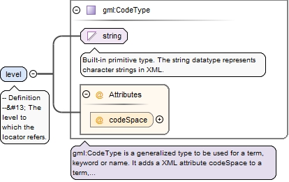
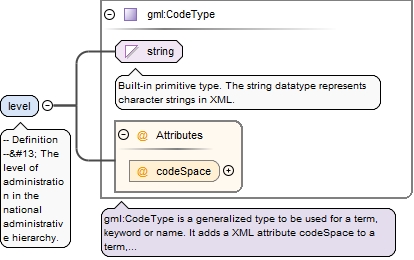
<element name="level" type="gml:CodeType"><annotation><documentation>-- Definition -- The level to which the locator refers.</documentation></annotation></element>
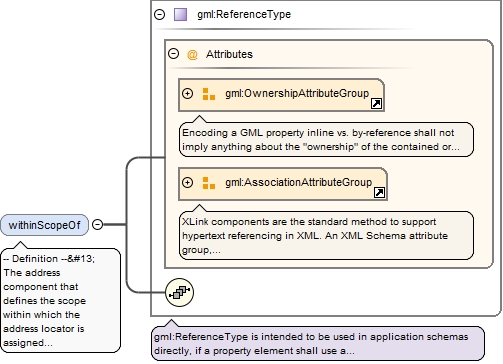
-- Definition -- The address component that defines the scope within which the address locator is assigned according to rules ensuring unambiguousness. -- Description -- NOTE 1 For the assignment of unambiguous locators (e.g. address numbers) different rules exists in different countries and regions. According to the most common rule, an address number should be unique within the scope of the thoroughfare name. In other areas the address number is unique inside an address area name (e.g. the name of the village) or postal designator (e.g. the post code). In some areas even a combination of rules are applied: e.g. addresses with two locators, each of them referencing to a separate address component. NOTE 2 Locators that has the level of unit (like e.g. floor identifier and door or unit identifiers) are most often assigned so that they are unambiguous within the more narrow scope of the property or building; for these locators the association should therefore not be populated. EXAMPLE 1 In a typical European address dataset, parts of the addresses have locators which are unambiguous within the scope of the road name (thoroughfare name) while others are unambiguous within the name ogf the village or district (address area name). EXAMPLE 2 In Lithuania and Estonia a concept of "corner addresses" exists. Corner addresses have two address numbers (designators) each of them referring to a thoroughfare name (primary and secondary street name). E.g. in Vilnius the address designated "A. Stulginskio gatve 4 / A. Smetonos gatve 7" is situated on the corner of the two streets. EXAMPLE 3 In the Czech Republic in some cities an address has two locator designators: A building number which referres to the address area (district, cz: "cast obce") and a address number that referres to the thoroughfare name. As an example in Praha for address designated "Na Pankráci 1690/125, Nusle" the designator "1690" is a building number unique within the address area (cz cast obce) "Nusle", while the "125" is an address number that has the thoroughfare name as its scope.
<element name="withinScopeOf" type="gml:ReferenceType" nillable="true" minOccurs="0"><annotation><documentation>-- Definition -- The address component that defines the scope within which the address locator is assigned according to rules ensuring unambiguousness. -- Description -- NOTE 1 For the assignment of unambiguous locators (e.g. address numbers) different rules exists in different countries and regions. According to the most common rule, an address number should be unique within the scope of the thoroughfare name. In other areas the address number is unique inside an address area name (e.g. the name of the village) or postal designator (e.g. the post code). In some areas even a combination of rules are applied: e.g. addresses with two locators, each of them referencing to a separate address component. NOTE 2 Locators that has the level of unit (like e.g. floor identifier and door or unit identifiers) are most often assigned so that they are unambiguous within the more narrow scope of the property or building; for these locators the association should therefore not be populated. EXAMPLE 1 In a typical European address dataset, parts of the addresses have locators which are unambiguous within the scope of the road name (thoroughfare name) while others are unambiguous within the name ogf the village or district (address area name). EXAMPLE 2 In Lithuania and Estonia a concept of "corner addresses" exists. Corner addresses have two address numbers (designators) each of them referring to a thoroughfare name (primary and secondary street name). E.g. in Vilnius the address designated "A. Stulginskio gatve 4 / A. Smetonos gatve 7" is situated on the corner of the two streets. EXAMPLE 3 In the Czech Republic in some cities an address has two locator designators: A building number which referres to the address area (district, cz: "cast obce") and a address number that referres to the thoroughfare name. As an example in Praha for address designated "Na Pankráci 1690/125, Nusle" the designator "1690" is a building number unique within the address area (cz cast obce) "Nusle", while the "125" is an address number that has the thoroughfare name as its scope.</documentation><appinfo><targetElement xmlns="http://www.opengis.net/gml/3.2">ad:AddressComponent</targetElement></appinfo></annotation></element>
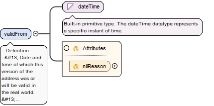
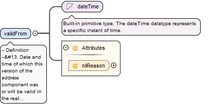
-- Definition -- Date and time of which this version of the address was or will be valid in the real world. -- Description -- NOTE This date and time can be set in the future for situations where an address or a version of an address has been decided by the appropriate authority to take effect for a future date.
<element name="validFrom" nillable="true"><annotation><documentation>-- Definition -- Date and time of which this version of the address was or will be valid in the real world. -- Description -- NOTE This date and time can be set in the future for situations where an address or a version of an address has been decided by the appropriate authority to take effect for a future date.</documentation></annotation><complexType><simpleContent><extension base="dateTime"><attribute name="nilReason" type="gml:NilReasonType"/></extension></simpleContent></complexType></element>
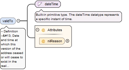
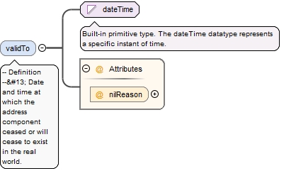
<element name="validTo" nillable="true" minOccurs="0"><annotation><documentation>-- Definition -- Date and time at which this version of the address ceased or will cease to exist in the real world.</documentation></annotation><complexType><simpleContent><extension base="dateTime"><attribute name="nilReason" type="gml:NilReasonType"/></extension></simpleContent></complexType></element>
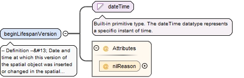
-- Definition -- Date and time at which this version of the spatial object was inserted or changed in the spatial data set. -- Description -- NOTE This date is recorded to enable the generation of change only update files.
<element name="beginLifespanVersion" nillable="true"><annotation><documentation>-- Definition -- Date and time at which this version of the spatial object was inserted or changed in the spatial data set. -- Description -- NOTE This date is recorded to enable the generation of change only update files.</documentation></annotation><complexType><simpleContent><extension base="dateTime"><attribute name="nilReason" type="gml:NilReasonType"/></extension></simpleContent></complexType></element>
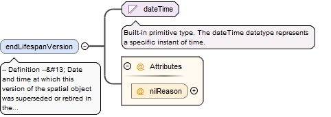
-- Definition -- Date and time at which this version of the spatial object was superseded or retired in the spatial data set. -- Description -- NOTE This date is recorded primarily for those systems which "close" an entry in the spatial data set in the event of an attribute change.
<element name="endLifespanVersion" nillable="true" minOccurs="0"><annotation><documentation>-- Definition -- Date and time at which this version of the spatial object was superseded or retired in the spatial data set. -- Description -- NOTE This date is recorded primarily for those systems which "close" an entry in the spatial data set in the event of an attribute change.</documentation></annotation><complexType><simpleContent><extension base="dateTime"><attribute name="nilReason" type="gml:NilReasonType"/></extension></simpleContent></complexType></element>
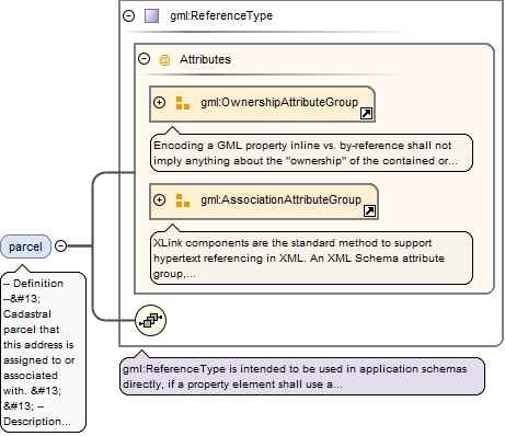
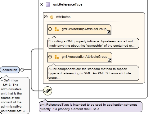
-- Definition -- Cadastral parcel that this address is assigned to or associated with. -- Description -- NOTE An address could potentially have an association to zero, one or several cadastral parcels. Also it is possible (but this is not expressed in this application schema) that several addresses are associated to a single cadastral parcel. EXAMPLE In the street "Wildersgade" in Copenhagen, Denmark, the address designated as "Wildersgade 66, 1408 København K" is associated to the cadastral parcel identifier "81" in the district of "Christianshavn".
<element name="parcel" type="gml:ReferenceType" nillable="true" minOccurs="0" maxOccurs="unbounded"><annotation><documentation>-- Definition -- Cadastral parcel that this address is assigned to or associated with. -- Description -- NOTE An address could potentially have an association to zero, one or several cadastral parcels. Also it is possible (but this is not expressed in this application schema) that several addresses are associated to a single cadastral parcel. EXAMPLE In the street "Wildersgade" in Copenhagen, Denmark, the address designated as "Wildersgade 66, 1408 København K" is associated to the cadastral parcel identifier "81" in the district of "Christianshavn".</documentation><appinfo><targetElement xmlns="http://www.opengis.net/gml/3.2">cp:CadastralParcel</targetElement></appinfo></annotation></element>
-- Definition -- The main (parent) address with which this (sub) address is tightly connected. -- Description -- NOTE 1 The relationship between a set of subaddresses and the main address most often means that the sub addresses use the same locator and address components (for example , thoroughfare name, address area, post code) as the parent address. For each sub address additional address locators are then included for identification, like e.g. flat number, floor identifier, door number. NOTE 2 In some countries several levels of parent-, sub- and sub-sub-addresses exist. In other countries the concept of parent addresses does not exist; all addresses are thus of the same level. EXAMPLE 1 In a Spanish city the address "Calle Gran Vía 8" is a parent address where the locator "8" represents the building. In the building, the sub address "Calle Gran Via 8, door 3" represents a sub-address, while the more detailed sub-sub address "Calle Gran Via 8, door 3, staircase A, floor 5, dwelling 1" represents the address of a specific dwelling. EXAMPLE 2 In Denmark the legislation on addresses define two types of addresses: the parent "access level" and the sub "unit level". In the city of Copenhagen "Wildersgade 60A" is a parent access address that represents a specific entrance to a building. Inside the entrance, subaddresses using floor and door designators identifies the individual dwellings like e.g. "Wildersgade 60A, 1st floor, left door". EXAMPLE 3 In The Netherlands only one level of addresses exists.
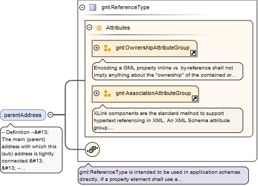
<element name="parentAddress" type="gml:ReferenceType" nillable="true" minOccurs="0"><annotation><documentation>-- Definition -- The main (parent) address with which this (sub) address is tightly connected. -- Description -- NOTE 1 The relationship between a set of subaddresses and the main address most often means that the sub addresses use the same locator and address components (for example , thoroughfare name, address area, post code) as the parent address. For each sub address additional address locators are then included for identification, like e.g. flat number, floor identifier, door number. NOTE 2 In some countries several levels of parent-, sub- and sub-sub-addresses exist. In other countries the concept of parent addresses does not exist; all addresses are thus of the same level. EXAMPLE 1 In a Spanish city the address "Calle Gran Vía 8" is a parent address where the locator "8" represents the building. In the building, the sub address "Calle Gran Via 8, door 3" represents a sub-address, while the more detailed sub-sub address "Calle Gran Via 8, door 3, staircase A, floor 5, dwelling 1" represents the address of a specific dwelling. EXAMPLE 2 In Denmark the legislation on addresses define two types of addresses: the parent "access level" and the sub "unit level". In the city of Copenhagen "Wildersgade 60A" is a parent access address that represents a specific entrance to a building. Inside the entrance, subaddresses using floor and door designators identifies the individual dwellings like e.g. "Wildersgade 60A, 1st floor, left door". EXAMPLE 3 In The Netherlands only one level of addresses exists.</documentation><appinfo><targetElement xmlns="http://www.opengis.net/gml/3.2">ad:Address</targetElement></appinfo></annotation></element>
-- Definition -- Building that the address is assigned to or associated with. -- Description -- NOTE An address could potentially have an association to zero, one or several buildings. Also it is possible (but this is not expressed in this application schema) that several addresses are associated to a single building. EXAMPLE In Praha, The Czech Republic, the address designated "NaPankráci 1690/125" is associated to a specific building in the street, in this case the building with number 1690 in the district (cz: cast obce) "Nusle".
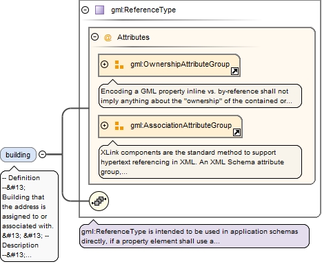
<element name="building" type="gml:ReferenceType" nillable="true" minOccurs="0" maxOccurs="unbounded"><annotation><documentation>-- Definition -- Building that the address is assigned to or associated with. -- Description -- NOTE An address could potentially have an association to zero, one or several buildings. Also it is possible (but this is not expressed in this application schema) that several addresses are associated to a single building. EXAMPLE In Praha, The Czech Republic, the address designated "NaPankráci 1690/125" is associated to a specific building in the street, in this case the building with number 1690 in the district (cz: cast obce) "Nusle".</documentation><appinfo><targetElement xmlns="http://www.opengis.net/gml/3.2">bui:Building</targetElement></appinfo></annotation></element>
-- Definition -- Represents that the address component is engaged as a part of the address. -- Description -- EXAMPLE For the address designated "Calle Mayor 13, Cortijo del Marqués, 41037, Écija, Sevilla, España" the six address components "Calle Mayor", "Cortijo del Marqués", "41037", "Écija", "Sevilla" and "España" are engaged as address components.
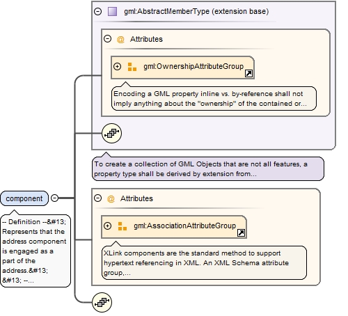
<element name="component" maxOccurs="unbounded"><annotation><documentation>-- Definition -- Represents that the address component is engaged as a part of the address. -- Description -- EXAMPLE For the address designated "Calle Mayor 13, Cortijo del Marqués, 41037, Écija, Sevilla, España" the six address components "Calle Mayor", "Cortijo del Marqués", "41037", "Écija", "Sevilla" and "España" are engaged as address components.</documentation><appinfo><targetElement xmlns="http://www.opengis.net/gml/3.2">ad:AddressComponent</targetElement></appinfo></annotation><complexType><complexContent><extension base="gml:AbstractMemberType"><sequence/><attributeGroup ref="gml:AssociationAttributeGroup"/></extension></complexContent></complexType></element>
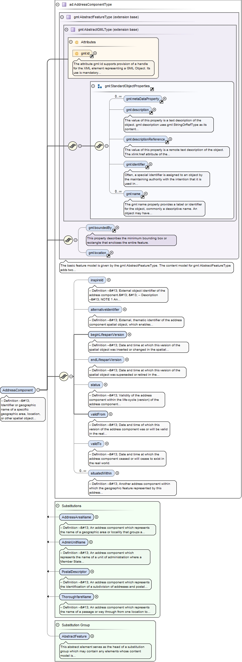
Element ad:AddressComponent
Namespace
urn:x-inspire:specification:gmlas:Addresses:3.0
Annotations
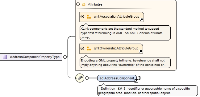
-- Definition -- Identifier or geographic name of a specific geographic area, location, or other spatial object which defines the scope of an address. -- Description -- NOTE 1 Four different subclasses of address components are defined: o Administrative unit name, which may include name of country, name of municipality, name of district o Address area name like e.g. name of village or settlement o Thoroughfare name, most often road name o Postal descriptor In order to construct an address, these subclasses are often structured hierarchically. NOTE 2 It is the combination of the address locator and the address components, which makes a specific address spatial object readable and unambiguous for the human user. EXAMPLE The combination of the locator "13" and the address components "Calle Mayor" (thoroughfare name), "Cortijo del Marqués" (address area name), "41037" (postal descriptor), "Écija", "Sevilla" and "España" (administrative unit names) makes this specific address spatial object readable and unambiguous.
The attribute gml:id supports provision of a handle for the XML element representing a GML Object. Its use is mandatory for all GML objects. It is of XML type ID, so is constrained to be unique in the XML document within which it occurs.
Source
<element name="AddressComponent" type="ad:AddressComponentType" abstract="true" substitutionGroup="gml:AbstractFeature"><annotation><documentation>-- Definition -- Identifier or geographic name of a specific geographic area, location, or other spatial object which defines the scope of an address. -- Description -- NOTE 1 Four different subclasses of address components are defined: o Administrative unit name, which may include name of country, name of municipality, name of district o Address area name like e.g. name of village or settlement o Thoroughfare name, most often road name o Postal descriptor In order to construct an address, these subclasses are often structured hierarchically. NOTE 2 It is the combination of the address locator and the address components, which makes a specific address spatial object readable and unambiguous for the human user. EXAMPLE The combination of the locator "13" and the address components "Calle Mayor" (thoroughfare name), "Cortijo del Marqués" (address area name), "41037" (postal descriptor), "Écija", "Sevilla" and "España" (administrative unit names) makes this specific address spatial object readable and unambiguous.</documentation></annotation></element>
-- Definition -- External object identifier of the address component. -- Description -- NOTE 1 An external object identifier is a unique object identifier published by the responsible body, which may be used by external applications to reference the spatial object. The identifier is an identifier of the spatial object, not an identifier of the real-world phenomenon. NOTE 2 The primary purpose of this identifier is to enable links between various sources and the address components. EXAMPLE An address component spatial object from Denmark could carry this identifier: Namespace: DK_ADR Local identifier: 0A3F507B2AB032B8E0440003BA298018 Version identifier: 12-02-2008T10:05:01+01:00
<element name="inspireId" type="base:IdentifierPropertyType" minOccurs="0"><annotation><documentation>-- Definition -- External object identifier of the address component. -- Description -- NOTE 1 An external object identifier is a unique object identifier published by the responsible body, which may be used by external applications to reference the spatial object. The identifier is an identifier of the spatial object, not an identifier of the real-world phenomenon. NOTE 2 The primary purpose of this identifier is to enable links between various sources and the address components. EXAMPLE An address component spatial object from Denmark could carry this identifier: Namespace: DK_ADR Local identifier: 0A3F507B2AB032B8E0440003BA298018 Version identifier: 12-02-2008T10:05:01+01:00</documentation></annotation></element>
-- Definition -- External, thematic identifier of the address component spatial object, which enables interoperability with existing legacy systems or applications. -- Description -- NOTE Compared with a proper identifier of the address component, the alternative identifier is not necessarily persistent in the lifetime of the component spatial object. Likewise it is usually not globally unique and in general does include information on the version of the spatial object. EXAMPLE 1 National or regional sector-specific identifiers (like e.g. a number- or letter code) for administrative units, address areas (localities, villages, sub-divisions) or thoroughfare names, which are used by a number of existing legacy systems. EXAMPLE 2 In Denmark the four character municipal "road name code" (0001-9899) is only unique within the present municipality, thus if two municipalities merge, it is necessary to assign new road name codes.
<element name="alternativeIdentifier" nillable="true" minOccurs="0"><annotation><documentation>-- Definition -- External, thematic identifier of the address component spatial object, which enables interoperability with existing legacy systems or applications. -- Description -- NOTE Compared with a proper identifier of the address component, the alternative identifier is not necessarily persistent in the lifetime of the component spatial object. Likewise it is usually not globally unique and in general does include information on the version of the spatial object. EXAMPLE 1 National or regional sector-specific identifiers (like e.g. a number- or letter code) for administrative units, address areas (localities, villages, sub-divisions) or thoroughfare names, which are used by a number of existing legacy systems. EXAMPLE 2 In Denmark the four character municipal "road name code" (0001-9899) is only unique within the present municipality, thus if two municipalities merge, it is necessary to assign new road name codes.</documentation></annotation><complexType><simpleContent><extension base="string"><attribute name="nilReason" type="gml:NilReasonType"/></extension></simpleContent></complexType></element>
-- Definition -- Date and time at which this version of the spatial object was inserted or changed in the spatial data set. -- Description -- NOTE This date is recorded to enable the generation of change only update files.
<element name="beginLifespanVersion" nillable="true"><annotation><documentation>-- Definition -- Date and time at which this version of the spatial object was inserted or changed in the spatial data set. -- Description -- NOTE This date is recorded to enable the generation of change only update files.</documentation></annotation><complexType><simpleContent><extension base="dateTime"><attribute name="nilReason" type="gml:NilReasonType"/></extension></simpleContent></complexType></element>
-- Definition -- Date and time at which this version of the spatial object was superseded or retired in the spatial data set. -- Description -- NOTE This date is recorded primarily for those systems which "close" an entry in the spatial data set in the event of an attribute change.
<element name="endLifespanVersion" nillable="true" minOccurs="0"><annotation><documentation>-- Definition -- Date and time at which this version of the spatial object was superseded or retired in the spatial data set. -- Description -- NOTE This date is recorded primarily for those systems which "close" an entry in the spatial data set in the event of an attribute change.</documentation></annotation><complexType><simpleContent><extension base="dateTime"><attribute name="nilReason" type="gml:NilReasonType"/></extension></simpleContent></complexType></element>
-- Definition -- Validity of the address component within the life-cycle (version) of the address component spatial object. -- Description -- NOTE This status relates to the address component and is not a property of the object to which the address is assigned (the addressable object).
<element name="status" nillable="true" minOccurs="0"><annotation><documentation>-- Definition -- Validity of the address component within the life-cycle (version) of the address component spatial object. -- Description -- NOTE This status relates to the address component and is not a property of the object to which the address is assigned (the addressable object).</documentation></annotation><complexType><simpleContent><extension base="gml:CodeType"><attribute name="nilReason" type="gml:NilReasonType"/></extension></simpleContent></complexType></element>
-- Definition -- Date and time of which this version of the address component was or will be valid in the real world. -- Description -- NOTE This date and time can be set in the future for situations where an address component or a version of an address component has been decided by the appropriate authority to take effect for a future date.
<element name="validFrom" nillable="true"><annotation><documentation>-- Definition -- Date and time of which this version of the address component was or will be valid in the real world. -- Description -- NOTE This date and time can be set in the future for situations where an address component or a version of an address component has been decided by the appropriate authority to take effect for a future date.</documentation></annotation><complexType><simpleContent><extension base="dateTime"><attribute name="nilReason" type="gml:NilReasonType"/></extension></simpleContent></complexType></element>
<element name="validTo" nillable="true" minOccurs="0"><annotation><documentation>-- Definition -- Date and time at which the address component ceased or will cease to exist in the real world.</documentation></annotation><complexType><simpleContent><extension base="dateTime"><attribute name="nilReason" type="gml:NilReasonType"/></extension></simpleContent></complexType></element>
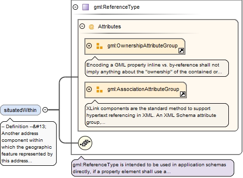
-- Definition -- Another address component within which the geographic feature represented by this address component is situated. -- Description -- NOTE 1 The association enables the application schema to express that the subtypes of address components in the dataset form a hierarchy e.g. like: thoroughfare name within municipality within region within country NOTE 2 The representation of the hierarchy facilitates queries e.g. for a specific thoroughfare name within a given municipality or postcode. It is also necessary where the application schema is used to create or update, for example , a gazetteer which is based on the hierarchical structure of the address components. NOTE 3 The multiplicity of the association allows it to express that a thoroughfare name is situated in a certain municipality and in a certain postcode. It is also possible to express, for example, that some thoroughfare names cross borders between municipalities and thus is situated within more than one municipality. EXAMPLE 1 In Spain many spatial objects of the thoroughfare name "Calle Santiago" exist. The association can express that one of the spatial objects is situated within in the municipality of Albacete. From the same example the municipality name "Albacete" is situated within the administrative name (region) of "Castilla La Mancha". EXAMPLE 2 In Denmark, several address area names entitled "Strandby" exists. In order to identify a specific spatial object it is necessary to know that the relevant spatial object is situated e.g. in the municipality of "Frederikshavn".
<element name="situatedWithin" type="gml:ReferenceType" nillable="true" minOccurs="0" maxOccurs="unbounded"><annotation><documentation>-- Definition -- Another address component within which the geographic feature represented by this address component is situated. -- Description -- NOTE 1 The association enables the application schema to express that the subtypes of address components in the dataset form a hierarchy e.g. like: thoroughfare name within municipality within region within country NOTE 2 The representation of the hierarchy facilitates queries e.g. for a specific thoroughfare name within a given municipality or postcode. It is also necessary where the application schema is used to create or update, for example , a gazetteer which is based on the hierarchical structure of the address components. NOTE 3 The multiplicity of the association allows it to express that a thoroughfare name is situated in a certain municipality and in a certain postcode. It is also possible to express, for example, that some thoroughfare names cross borders between municipalities and thus is situated within more than one municipality. EXAMPLE 1 In Spain many spatial objects of the thoroughfare name "Calle Santiago" exist. The association can express that one of the spatial objects is situated within in the municipality of Albacete. From the same example the municipality name "Albacete" is situated within the administrative name (region) of "Castilla La Mancha". EXAMPLE 2 In Denmark, several address area names entitled "Strandby" exists. In order to identify a specific spatial object it is necessary to know that the relevant spatial object is situated e.g. in the municipality of "Frederikshavn".</documentation><appinfo><targetElement xmlns="http://www.opengis.net/gml/3.2">ad:AddressComponent</targetElement></appinfo></annotation></element>
Element ad:PartOfName
Namespace
urn:x-inspire:specification:gmlas:Addresses:3.0
Annotations
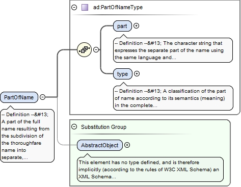
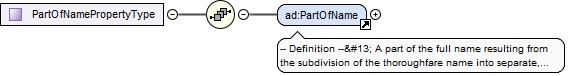
-- Definition -- A part of the full name resulting from the subdivision of the thoroughfare name into separate, semantic parts, using the same language and script as the full thoroughfare name. -- Description -- NOTE Each part of the name must be qualified by using the type attribute.
<element name="PartOfName" type="ad:PartOfNameType" substitutionGroup="gml:AbstractObject"><annotation><documentation>-- Definition -- A part of the full name resulting from the subdivision of the thoroughfare name into separate, semantic parts, using the same language and script as the full thoroughfare name. -- Description -- NOTE Each part of the name must be qualified by using the type attribute.</documentation></annotation></element>
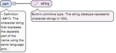
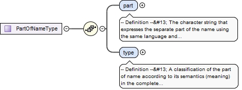
-- Definition -- The character string that expresses the separate part of the name using the same language and script as the full thoroughfare name.
Diagram
Type
string
Properties
content
simple
Source
<element name="part" type="string"><annotation><documentation>-- Definition -- The character string that expresses the separate part of the name using the same language and script as the full thoroughfare name.</documentation></annotation></element>
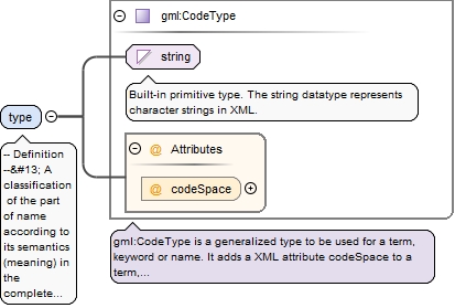
<element name="type" type="gml:CodeType"><annotation><documentation>-- Definition -- A classification of the part of name according to its semantics (meaning) in the complete thoroughfare name.</documentation></annotation></element>
Element ad:AddressAreaName
Namespace
urn:x-inspire:specification:gmlas:Addresses:3.0
Annotations
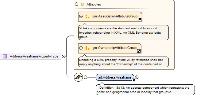
-- Definition -- An address component which represents the name of a geographic area or locality that groups a number of addressable objects for addressing purposes, without being an administrative unit. -- Description -- NOTE 1 In some countries and regions an address area is a true subdivision of an administrative unit (most often a municipality), so that every address area is fully inside the municipality and so that every part of the municipality is within an address area. In other countries, the concept of address area names is less strict and based on local tradition or specific needs. NOTE 2 In some situations an address area name is not required to obtain unambiguousness; instead the purpose is to make the complete address more informative and descriptive, adding a well known place name (e.g. of a village or community) to the address. This is particularly useful if the municipality or post code covers a large area. EXAMPLE 1 In Sweden a "Kommundel" (en: Municipal sub division) is a type of address area names that ensures that street names are unique within the sub division. EXAMPLE 2 In Spain an "Entidad de población" (en: population entity) has the same function. It is the general address area which depending on its characteristics can be classified as "Entidad Singular" (en: singular entity) or "Entidad Colectiva" (en: collective entity). Moreover, according to the population distribution, these areas can contain one or several "Núcleo de población" (en: population core) and/or "Población diseminada" (en: scattered population). EXAMPLE 3 In Denmark "Supplerende bynavn" (en: Supplementary town name) is sometimes compulsory to ensure uniqueness of street names within the post code, sometimes it is just useful extra information, that makes the address more informative.
The attribute gml:id supports provision of a handle for the XML element representing a GML Object. Its use is mandatory for all GML objects. It is of XML type ID, so is constrained to be unique in the XML document within which it occurs.
Source
<element name="AddressAreaName" type="ad:AddressAreaNameType" substitutionGroup="ad:AddressComponent"><annotation><documentation>-- Definition -- An address component which represents the name of a geographic area or locality that groups a number of addressable objects for addressing purposes, without being an administrative unit. -- Description -- NOTE 1 In some countries and regions an address area is a true subdivision of an administrative unit (most often a municipality), so that every address area is fully inside the municipality and so that every part of the municipality is within an address area. In other countries, the concept of address area names is less strict and based on local tradition or specific needs. NOTE 2 In some situations an address area name is not required to obtain unambiguousness; instead the purpose is to make the complete address more informative and descriptive, adding a well known place name (e.g. of a village or community) to the address. This is particularly useful if the municipality or post code covers a large area. EXAMPLE 1 In Sweden a "Kommundel" (en: Municipal sub division) is a type of address area names that ensures that street names are unique within the sub division. EXAMPLE 2 In Spain an "Entidad de población" (en: population entity) has the same function. It is the general address area which depending on its characteristics can be classified as "Entidad Singular" (en: singular entity) or "Entidad Colectiva" (en: collective entity). Moreover, according to the population distribution, these areas can contain one or several "Núcleo de población" (en: population core) and/or "Población diseminada" (en: scattered population). EXAMPLE 3 In Denmark "Supplerende bynavn" (en: Supplementary town name) is sometimes compulsory to ensure uniqueness of street names within the post code, sometimes it is just useful extra information, that makes the address more informative.</documentation></annotation></element>
-- Definition -- Proper noun applied to the address area. -- Description -- NOTE The data type allows names in different languages and scripts as well as inclusion of alternative name, alternative spellings, historical name and exonyms.
<element name="name" type="gn:GeographicalNamePropertyType" maxOccurs="unbounded"><annotation><documentation>-- Definition -- Proper noun applied to the address area. -- Description -- NOTE The data type allows names in different languages and scripts as well as inclusion of alternative name, alternative spellings, historical name and exonyms.</documentation></annotation></element>
-- Definition -- The named place that this address area name represents. -- Description -- NOTE In order to populate this association, it is important that the area covered by the identified Named Place is exactly the same as the area covered by the address area name in question; if this is not the case the association would result in an inconsistency. EXAMPLE The geographical name "Huskvarna", which represents a part of the municipality of Jönköping in Sweden, is the source of the address area name, "Huskvarna".
<element name="namedPlace" type="gml:ReferenceType" nillable="true" minOccurs="0"><annotation><documentation>-- Definition -- The named place that this address area name represents. -- Description -- NOTE In order to populate this association, it is important that the area covered by the identified Named Place is exactly the same as the area covered by the address area name in question; if this is not the case the association would result in an inconsistency. EXAMPLE The geographical name "Huskvarna", which represents a part of the municipality of Jönköping in Sweden, is the source of the address area name, "Huskvarna".</documentation><appinfo><targetElement xmlns="http://www.opengis.net/gml/3.2">gn:NamedPlace</targetElement></appinfo></annotation></element>
Element ad:ThoroughfareName
Namespace
urn:x-inspire:specification:gmlas:Addresses:3.0
Annotations
-- Definition -- An address component which represents the name of a passage or way through from one location to another. -- Description -- NOTE 1 A thoroughfare can, e.g., be a road or a waterway NOTE 2 Thoroughfare names includes names of squares and of cul de sacs, and they can also represent the network of smaller roads or paths e.g. in a small village or settlement.
The attribute gml:id supports provision of a handle for the XML element representing a GML Object. Its use is mandatory for all GML objects. It is of XML type ID, so is constrained to be unique in the XML document within which it occurs.
Source
<element name="ThoroughfareName" type="ad:ThoroughfareNameType" substitutionGroup="ad:AddressComponent"><annotation><documentation>-- Definition -- An address component which represents the name of a passage or way through from one location to another. -- Description -- NOTE 1 A thoroughfare can, e.g., be a road or a waterway NOTE 2 Thoroughfare names includes names of squares and of cul de sacs, and they can also represent the network of smaller roads or paths e.g. in a small village or settlement.</documentation></annotation></element>
-- Definition -- Name of the thoroughfare. -- Description -- NOTE 1 The name can optionally include an often used alternative name, alternative spelling of the name, a historic name or spelling, which is still in use. It may also optionally include a subdivision of the name into parts. NOTE 2 Most often thoroughfares are roads, in this situation the thoroughfare name is the road name. NOTE 3 The data type also allows a representation of the thoroughfare name in separate parts e.g. "rue" + "de la" + "Paix"
<element name="name" type="ad:ThoroughfareNameValuePropertyType" maxOccurs="unbounded"><annotation><documentation>-- Definition -- Name of the thoroughfare. -- Description -- NOTE 1 The name can optionally include an often used alternative name, alternative spelling of the name, a historic name or spelling, which is still in use. It may also optionally include a subdivision of the name into parts. NOTE 2 Most often thoroughfares are roads, in this situation the thoroughfare name is the road name. NOTE 3 The data type also allows a representation of the thoroughfare name in separate parts e.g. "rue" + "de la" + "Paix"</documentation></annotation></element>
Element ad:ThoroughfareNameValue
Namespace
urn:x-inspire:specification:gmlas:Addresses:3.0
Annotations
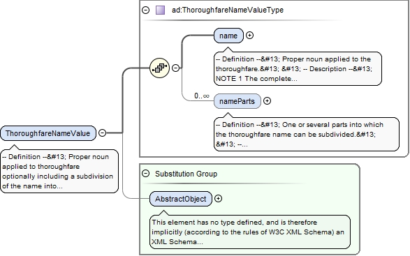
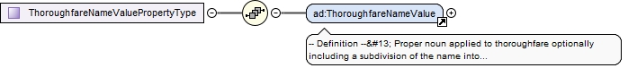
-- Definition -- Proper noun applied to thoroughfare optionally including a subdivision of the name into parts. -- Description -- NOTE 1 The data type allows names in different languages and scripts as well as inclusion of alternative name, alternative spellings, historical name and exonyms. NOTE 2 The data type allows optionally a representation of the thoroughfare name subdivided into separate, semantic parts e.g. "Avenue" + "de la" + "Poste".
<element name="ThoroughfareNameValue" type="ad:ThoroughfareNameValueType" substitutionGroup="gml:AbstractObject"><annotation><documentation>-- Definition -- Proper noun applied to thoroughfare optionally including a subdivision of the name into parts. -- Description -- NOTE 1 The data type allows names in different languages and scripts as well as inclusion of alternative name, alternative spellings, historical name and exonyms. NOTE 2 The data type allows optionally a representation of the thoroughfare name subdivided into separate, semantic parts e.g. "Avenue" + "de la" + "Poste".</documentation></annotation></element>
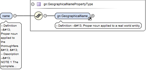
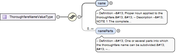
-- Definition -- Proper noun applied to the thoroughfare. -- Description -- NOTE 1 The complete name of the thoroughfare must be applied in this attribute, including type, prefix or qualifier, like for example "Avenue de la Poste", "Calle del Christo Canneregio" or "Untere Quai". The name part attribute enables a representation of the name subdivided into separate semantic parts. NOTE 2 The data type allows names in different languages as well as inclusion of exonyms.
<element name="name" type="gn:GeographicalNamePropertyType"><annotation><documentation>-- Definition -- Proper noun applied to the thoroughfare. -- Description -- NOTE 1 The complete name of the thoroughfare must be applied in this attribute, including type, prefix or qualifier, like for example "Avenue de la Poste", "Calle del Christo Canneregio" or "Untere Quai". The name part attribute enables a representation of the name subdivided into separate semantic parts. NOTE 2 The data type allows names in different languages as well as inclusion of exonyms.</documentation></annotation></element>
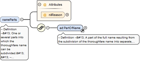
-- Definition -- One or several parts into which the thoroughfare name can be subdivided. -- Description -- NOTE 1 This is a definition which is consistent with that adopted by the UPU NOTE 2 A subdivision of a thoroughfare name into semantic parts could improve parsing (e.g. of abbreviated or misspelled names) and for sorting of address data for example for postal delivery purposes. It could also improve the creation of alphabetically sorted street gazetteers. NOTE 3 The data type requires that each part of the subdivided thoroughfare name is qualified with information on the semantics e.g. if it is a thoroughfare type (e.g., Rua, Place, Calle, Street), a prefix (e.g., da, de la, del), a qualifier (e.g., Unterer, Little) or if it is the core of the name, which would normally be used for sorting or indexing. NOTE 4 In some countries or regions and for some thoroughfare names it is not feasible or it does not add value to subdivide the thoroughfare name into parts. EXAMPLE In France the thoroughfare name "Avenue de la Poste" could be subdivided into these parts: "Avenue" + "de la" + "Poste".
<element name="nameParts" nillable="true" minOccurs="0" maxOccurs="unbounded"><annotation><documentation>-- Definition -- One or several parts into which the thoroughfare name can be subdivided. -- Description -- NOTE 1 This is a definition which is consistent with that adopted by the UPU NOTE 2 A subdivision of a thoroughfare name into semantic parts could improve parsing (e.g. of abbreviated or misspelled names) and for sorting of address data for example for postal delivery purposes. It could also improve the creation of alphabetically sorted street gazetteers. NOTE 3 The data type requires that each part of the subdivided thoroughfare name is qualified with information on the semantics e.g. if it is a thoroughfare type (e.g., Rua, Place, Calle, Street), a prefix (e.g., da, de la, del), a qualifier (e.g., Unterer, Little) or if it is the core of the name, which would normally be used for sorting or indexing. NOTE 4 In some countries or regions and for some thoroughfare names it is not feasible or it does not add value to subdivide the thoroughfare name into parts. EXAMPLE In France the thoroughfare name "Avenue de la Poste" could be subdivided into these parts: "Avenue" + "de la" + "Poste".</documentation></annotation><complexType><sequence><element ref="ad:PartOfName"/></sequence><attribute name="nilReason" type="gml:NilReasonType"/></complexType></element>
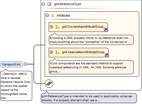
-- Definition -- One or several transport network links to which the spatial object of the thoroughfare name has been designated. -- Description -- EXAMPLE The thoroughfare name "Na Pankráci" in Praha, The Czech Republic, has been designated as a road name for a number of road links (street segments) in the city.
<element name="transportLink" type="gml:ReferenceType" nillable="true" minOccurs="0" maxOccurs="unbounded"><annotation><documentation>-- Definition -- One or several transport network links to which the spatial object of the thoroughfare name has been designated. -- Description -- EXAMPLE The thoroughfare name "Na Pankráci" in Praha, The Czech Republic, has been designated as a road name for a number of road links (street segments) in the city.</documentation><appinfo><targetElement xmlns="http://www.opengis.net/gml/3.2">tn:TransportLink</targetElement></appinfo></annotation></element>
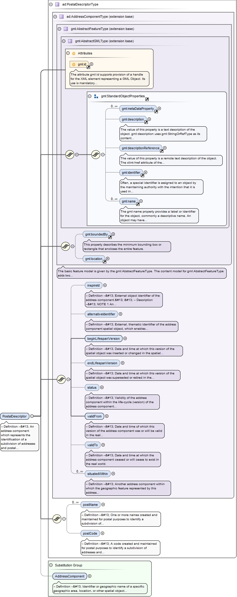
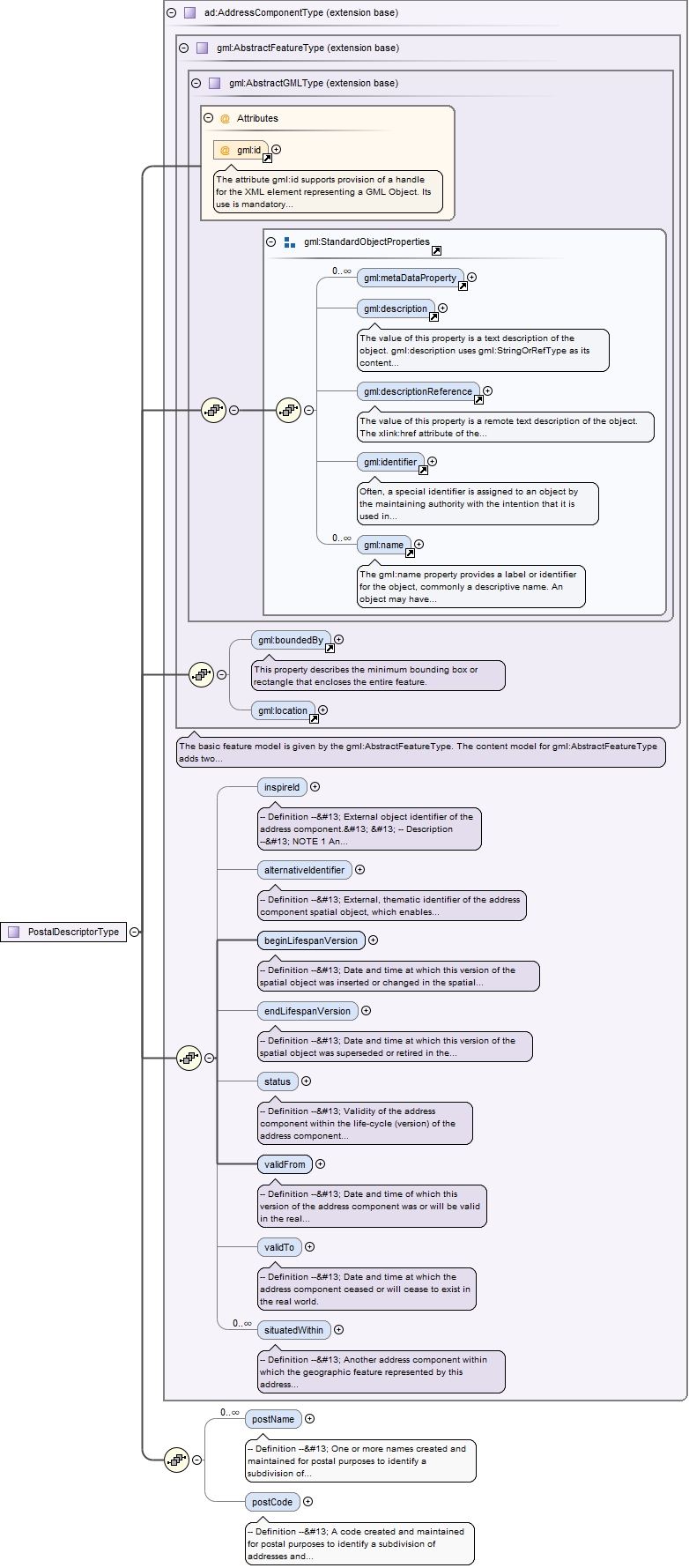
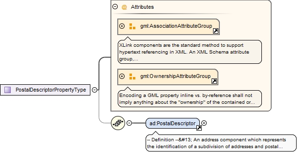
Element ad:PostalDescriptor
Namespace
urn:x-inspire:specification:gmlas:Addresses:3.0
Annotations
-- Definition -- An address component which represents the identification of a subdivision of addresses and postal delivery points in a country, region or city for postal purposes. -- Description -- NOTE 1 The postal descriptor is specified by means of a post code and/or names of the associated post office, town or area. NOTE 2 In some countries post codes are seen as a proper geographic subdivision of the country, in other countries the post code is regarded only as an attribute that characterizes a (usually small) number of adjacent postal delivery points and addresses. NOTE 3 The postal descriptors are created and developed on the basis of postal requirements (e.g. efficient sorting, logistics, transport and distribution). Consequently, there is not often a tight relationship between the postal areas and administrative units in the same area. NOTE 4 The structure schema and formats of national postal descriptor systems are different. Sometimes (for example in the UK) the post code itself is the only information required for a valid address; in other situations both the post code and the associated name of post office or town is required. Sometimes there is a simple relationship between the code and the name; in other situations a set of postcodes are associated with a single post office or town. NOTE 5 In some countries like e.g. The Republic of Ireland, no post code system currently exists, therefore the postal descriptor is only represented by the name of the post town. EXAMPLE 1 In the UK the post code "EC4M 7DR" is sufficient, as a postal descriptor, while the related town name "London" is informative, but not necessary in the postal address. EXAMPLE 2 In Sweden all postcodes starting with "80" is related to the postal name "Gävle". Therefore in the postal descriptor "802 74 Gävle", the postcode "802 74" bears all postal necessary information, while the town name "Gävle" is extra information. EXAMPLE 3 In Denmark, outside the centre of Copenhagen, each postcode has a 1:1 relationship to one post name only: Postcode "6372" relates to the village "Bylderup-Bov". EXAMPLE 4 In Germany the lowest level of the Postal descriptor (the 5 digit Postleitzahl) often does not fall within an administrative unit (e.g. municipality). The Postleitzahl is handled completely independent from the hierarchal systematic of the addresses. In addition, some "Postleitzahlen" represent not a delivery area, but institutions with a big amount of post.
The attribute gml:id supports provision of a handle for the XML element representing a GML Object. Its use is mandatory for all GML objects. It is of XML type ID, so is constrained to be unique in the XML document within which it occurs.
Source
<element name="PostalDescriptor" type="ad:PostalDescriptorType" substitutionGroup="ad:AddressComponent"><annotation><documentation>-- Definition -- An address component which represents the identification of a subdivision of addresses and postal delivery points in a country, region or city for postal purposes. -- Description -- NOTE 1 The postal descriptor is specified by means of a post code and/or names of the associated post office, town or area. NOTE 2 In some countries post codes are seen as a proper geographic subdivision of the country, in other countries the post code is regarded only as an attribute that characterizes a (usually small) number of adjacent postal delivery points and addresses. NOTE 3 The postal descriptors are created and developed on the basis of postal requirements (e.g. efficient sorting, logistics, transport and distribution). Consequently, there is not often a tight relationship between the postal areas and administrative units in the same area. NOTE 4 The structure schema and formats of national postal descriptor systems are different. Sometimes (for example in the UK) the post code itself is the only information required for a valid address; in other situations both the post code and the associated name of post office or town is required. Sometimes there is a simple relationship between the code and the name; in other situations a set of postcodes are associated with a single post office or town. NOTE 5 In some countries like e.g. The Republic of Ireland, no post code system currently exists, therefore the postal descriptor is only represented by the name of the post town. EXAMPLE 1 In the UK the post code "EC4M 7DR" is sufficient, as a postal descriptor, while the related town name "London" is informative, but not necessary in the postal address. EXAMPLE 2 In Sweden all postcodes starting with "80" is related to the postal name "Gävle". Therefore in the postal descriptor "802 74 Gävle", the postcode "802 74" bears all postal necessary information, while the town name "Gävle" is extra information. EXAMPLE 3 In Denmark, outside the centre of Copenhagen, each postcode has a 1:1 relationship to one post name only: Postcode "6372" relates to the village "Bylderup-Bov". EXAMPLE 4 In Germany the lowest level of the Postal descriptor (the 5 digit Postleitzahl) often does not fall within an administrative unit (e.g. municipality). The Postleitzahl is handled completely independent from the hierarchal systematic of the addresses. In addition, some "Postleitzahlen" represent not a delivery area, but institutions with a big amount of post.</documentation></annotation></element>
-- Definition -- One or more names created and maintained for postal purposes to identify a subdivision of addresses and postal delivery points. -- Description -- NOTE 1 Often the post name (or names) is a supplementary identification of the post office to which the associated post code belongs. For example it may be the name of the town in which the office is situated. In other situations the post name could be an independent descriptor without any post code or it could be a postal subdivision connected to a parent postal descriptor (post code and post name). NOTE 2 In some countries like e.g. Spain and The Netherlands, no post names exit therefore the postal descriptor is only represented by the post code. NOTE 3 Even though the post name is the same as the name of an administrative unit or an address area, the area covered are not necessarilythe same.
<element name="postName" type="gn:GeographicalNamePropertyType" minOccurs="0" maxOccurs="unbounded"><annotation><documentation>-- Definition -- One or more names created and maintained for postal purposes to identify a subdivision of addresses and postal delivery points. -- Description -- NOTE 1 Often the post name (or names) is a supplementary identification of the post office to which the associated post code belongs. For example it may be the name of the town in which the office is situated. In other situations the post name could be an independent descriptor without any post code or it could be a postal subdivision connected to a parent postal descriptor (post code and post name). NOTE 2 In some countries like e.g. Spain and The Netherlands, no post names exit therefore the postal descriptor is only represented by the post code. NOTE 3 Even though the post name is the same as the name of an administrative unit or an address area, the area covered are not necessarilythe same.</documentation></annotation></element>
-- Definition -- A code created and maintained for postal purposes to identify a subdivision of addresses and postal delivery points. -- Description -- NOTE 1 The structure, schema and formats of post codes are different in different countries. Often the components of the post code are hierarchical, e.g. when the first character(s) identifies the region covered by the post code and the next characters define the subdivision. NOTE 2 In some countries, e.g., The Republic of Ireland, no post codes exists therefore the postal descriptor is only represented by the post name (e.g. town name). EXAMPLE In the UK postcodes starting with W covers the Western (W1) and Paddington (W2-14) districts of the London postal district. In Sweden all postcodes starting with "80" is related to the postal name "Gävle".
Diagram
Type
string
Properties
content
simple
minOccurs
0
Source
<element name="postCode" type="string" minOccurs="0"><annotation><documentation>-- Definition -- A code created and maintained for postal purposes to identify a subdivision of addresses and postal delivery points. -- Description -- NOTE 1 The structure, schema and formats of post codes are different in different countries. Often the components of the post code are hierarchical, e.g. when the first character(s) identifies the region covered by the post code and the next characters define the subdivision. NOTE 2 In some countries, e.g., The Republic of Ireland, no post codes exists therefore the postal descriptor is only represented by the post name (e.g. town name). EXAMPLE In the UK postcodes starting with W covers the Western (W1) and Paddington (W2-14) districts of the London postal district. In Sweden all postcodes starting with "80" is related to the postal name "Gävle".</documentation></annotation></element>
Element ad:AdminUnitName
Namespace
urn:x-inspire:specification:gmlas:Addresses:3.0
Annotations
-- Definition --
 An address component which represents the name of a unit of administration where a Member State has and/or exercises jurisdictional rights, for local, regional and national governance.
The attribute gml:id supports provision of a handle for the XML element representing a GML Object. Its use is mandatory for all GML objects. It is of XML type ID, so is constrained to be unique in the XML document within which it occurs.
Source
<element name="AdminUnitName" type="ad:AdminUnitNameType" substitutionGroup="ad:AddressComponent"><annotation><documentation>-- Definition -- An address component which represents the name of a unit of administration where a Member State has and/or exercises jurisdictional rights, for local, regional and national governance.</documentation></annotation></element>
-- Definition --
 Official, geographical name of the administrative unit, given in different languages where required.


 -- Description --
 NOTE The data type allows names in different languages and scripts as well as inclusion of alternative name, alternative spellings, historical name and exonyms.
<element name="name" type="gn:GeographicalNamePropertyType" maxOccurs="unbounded"><annotation><documentation>-- Definition -- Official, geographical name of the administrative unit, given in different languages where required. -- Description -- NOTE The data type allows names in different languages and scripts as well as inclusion of alternative name, alternative spellings, historical name and exonyms.</documentation></annotation></element>
<element name="level" type="gml:CodeType"><annotation><documentation>-- Definition -- The level of administration in the national administrative hierarchy.</documentation></annotation></element>
-- Definition --
 The administrative unit that is the source of the content of the administrative unit name.


 -- Description --
 EXAMPLE The administrative unit (municipality) "Gävle" in Sweden is the source of the address component administrative unit name, "Gävle".
<element name="adminUnit" type="gml:ReferenceType" nillable="true"><annotation><documentation>-- Definition -- The administrative unit that is the source of the content of the administrative unit name. -- Description -- EXAMPLE The administrative unit (municipality) "Gävle" in Sweden is the source of the address component administrative unit name, "Gävle".</documentation><appinfo><targetElement xmlns="http://www.opengis.net/gml/3.2">au:AdministrativeUnit</targetElement></appinfo></annotation></element>
<complexType name="AddressRepresentationType"><sequence><element name="adminUnit" type="gn:GeographicalNamePropertyType" maxOccurs="unbounded"><annotation><documentation>-- Definition -- The name or names of a unit of administration where a Member State has and/or exercises jurisdictional rights, for local, regional and national governance.</documentation></annotation></element><element name="locatorDesignator" type="string" minOccurs="0" maxOccurs="unbounded"><annotation><documentation>-- Definition -- A number or a sequence of characters which allows a user or an application to interpret, parse and format the locator within the relevant scope. A locator may include more locator designators.</documentation></annotation></element><element name="locatorName" type="gn:GeographicalNamePropertyType" minOccurs="0" maxOccurs="unbounded"><annotation><documentation>-- Definition -- Proper noun(s) applied to the real world entity identified by the locator.</documentation></annotation></element><element name="addressArea" nillable="true" minOccurs="0" maxOccurs="unbounded"><annotation><documentation>-- Definition -- The name or names of a geographic area or locality that groups a number of addressable objects for addressing purposes, without being an administrative unit.</documentation></annotation><complexType><sequence><element ref="gn:GeographicalName"/></sequence><attribute name="nilReason" type="gml:NilReasonType"/></complexType></element><element name="postName" nillable="true" minOccurs="0" maxOccurs="unbounded"><annotation><documentation>-- Definition -- One or more names created and maintained for postal purposes to identify a subdivision of addresses and postal delivery points.</documentation></annotation><complexType><sequence><element ref="gn:GeographicalName"/></sequence><attribute name="nilReason" type="gml:NilReasonType"/></complexType></element><element name="postCode" nillable="true" minOccurs="0"><annotation><documentation>-- Definition -- A code created and maintained for postal purposes to identify a subdivision of addresses and postal delivery points.</documentation></annotation><complexType><simpleContent><extension base="string"><attribute name="nilReason" type="gml:NilReasonType"/></extension></simpleContent></complexType></element><element name="thoroughfare" nillable="true" minOccurs="0" maxOccurs="unbounded"><annotation><documentation>-- Definition -- The name or names of a passage or way through from one location to another like a road or a waterway.</documentation></annotation><complexType><sequence><element ref="gn:GeographicalName"/></sequence><attribute name="nilReason" type="gml:NilReasonType"/></complexType></element><element name="addressFeature" type="gml:ReferenceType" nillable="true" minOccurs="0"><annotation><documentation>-- Definition -- Reference to the address spatial object. </documentation><appinfo><targetElement xmlns="http://www.opengis.net/gml/3.2">ad:Address</targetElement></appinfo></annotation></element></sequence></complexType>
The attribute gml:id supports provision of a handle for the XML element representing a GML Object. Its use is mandatory for all GML objects. It is of XML type ID, so is constrained to be unique in the XML document within which it occurs.
Source
<complexType name="AddressType"><complexContent><extension base="gml:AbstractFeatureType"><sequence><element name="inspireId" type="base:IdentifierPropertyType"><annotation><documentation>-- Definition -- External object identifier of the address. -- Description -- NOTE 1 An external object identifier is a unique object identifier published by the responsible body, which may be used by external applications to reference the spatial object. The identifier is an identifier of the spatial object, not an identifier of the addressable object. NOTE 2 The primary purpose of this identifier is to enable links between various sources and the address components. EXAMPLE An address spatial object from Denmark could carry this identifier: Namespace: DK_ADR Local identifier: 0A3F507B2AB032B8E0440003BA298018 Version identifier: 12-02-2008T10:05:01+01:00</documentation></annotation></element><element name="alternativeIdentifier" nillable="true" minOccurs="0"><annotation><documentation>-- Definition -- External, thematic identifier of the address spatial object, which enables interoperability with existing legacy systems or applications. -- Description -- NOTE 1 Compared with the proper identifier of the address, the alternative identifier is not necessarily persistent in the lifetime of the address spatial object. Likewise it is usually not globally unique and in general does not include information on the version of the address spatial object. NOTE 2 Often alternative address identifiers are composed by a set of codes that, e.g., identify the region and the municipality, the thoroughfare name and the address number. These alternative identifiers will not remain persistent e.g. in the case of the merging of two municipalities. EXAMPLE In Denmark many legacy systems (e.g. in the Statistics Denmark or the Central Business Register) uses as address identification the three digit municipality code plus the four character street name code plus the address number.</documentation></annotation><complexType><simpleContent><extension base="string"><attribute name="nilReason" type="gml:NilReasonType"/></extension></simpleContent></complexType></element><element name="position" type="ad:GeographicPositionPropertyType" maxOccurs="unbounded"><annotation><documentation>-- Definition -- Position of a characteristic point which represents the location of the address according to a certain specification, including information on the origin of the position.</documentation></annotation></element><element name="status" nillable="true" minOccurs="0"><annotation><documentation>-- Definition -- Validity of the address within the life-cycle (version) of the address spatial object. -- Description -- NOTE This status relates to the address and is not a property of the object to which the address is assigned (the addressable object).</documentation></annotation><complexType><simpleContent><extension base="gml:CodeType"><attribute name="nilReason" type="gml:NilReasonType"/></extension></simpleContent></complexType></element><element name="locator" type="ad:AddressLocatorPropertyType" maxOccurs="unbounded"><annotation><documentation>-- Definition -- Human readable designator or name.</documentation></annotation></element><element name="validFrom" nillable="true"><annotation><documentation>-- Definition -- Date and time of which this version of the address was or will be valid in the real world. -- Description -- NOTE This date and time can be set in the future for situations where an address or a version of an address has been decided by the appropriate authority to take effect for a future date.</documentation></annotation><complexType><simpleContent><extension base="dateTime"><attribute name="nilReason" type="gml:NilReasonType"/></extension></simpleContent></complexType></element><element name="validTo" nillable="true" minOccurs="0"><annotation><documentation>-- Definition -- Date and time at which this version of the address ceased or will cease to exist in the real world.</documentation></annotation><complexType><simpleContent><extension base="dateTime"><attribute name="nilReason" type="gml:NilReasonType"/></extension></simpleContent></complexType></element><element name="beginLifespanVersion" nillable="true"><annotation><documentation>-- Definition -- Date and time at which this version of the spatial object was inserted or changed in the spatial data set. -- Description -- NOTE This date is recorded to enable the generation of change only update files.</documentation></annotation><complexType><simpleContent><extension base="dateTime"><attribute name="nilReason" type="gml:NilReasonType"/></extension></simpleContent></complexType></element><element name="endLifespanVersion" nillable="true" minOccurs="0"><annotation><documentation>-- Definition -- Date and time at which this version of the spatial object was superseded or retired in the spatial data set. -- Description -- NOTE This date is recorded primarily for those systems which "close" an entry in the spatial data set in the event of an attribute change.</documentation></annotation><complexType><simpleContent><extension base="dateTime"><attribute name="nilReason" type="gml:NilReasonType"/></extension></simpleContent></complexType></element><element name="parcel" type="gml:ReferenceType" nillable="true" minOccurs="0" maxOccurs="unbounded"><annotation><documentation>-- Definition -- Cadastral parcel that this address is assigned to or associated with. -- Description -- NOTE An address could potentially have an association to zero, one or several cadastral parcels. Also it is possible (but this is not expressed in this application schema) that several addresses are associated to a single cadastral parcel. EXAMPLE In the street "Wildersgade" in Copenhagen, Denmark, the address designated as "Wildersgade 66, 1408 København K" is associated to the cadastral parcel identifier "81" in the district of "Christianshavn".</documentation><appinfo><targetElement xmlns="http://www.opengis.net/gml/3.2">cp:CadastralParcel</targetElement></appinfo></annotation></element><element name="parentAddress" type="gml:ReferenceType" nillable="true" minOccurs="0"><annotation><documentation>-- Definition -- The main (parent) address with which this (sub) address is tightly connected. -- Description -- NOTE 1 The relationship between a set of subaddresses and the main address most often means that the sub addresses use the same locator and address components (for example , thoroughfare name, address area, post code) as the parent address. For each sub address additional address locators are then included for identification, like e.g. flat number, floor identifier, door number. NOTE 2 In some countries several levels of parent-, sub- and sub-sub-addresses exist. In other countries the concept of parent addresses does not exist; all addresses are thus of the same level. EXAMPLE 1 In a Spanish city the address "Calle Gran Vía 8" is a parent address where the locator "8" represents the building. In the building, the sub address "Calle Gran Via 8, door 3" represents a sub-address, while the more detailed sub-sub address "Calle Gran Via 8, door 3, staircase A, floor 5, dwelling 1" represents the address of a specific dwelling. EXAMPLE 2 In Denmark the legislation on addresses define two types of addresses: the parent "access level" and the sub "unit level". In the city of Copenhagen "Wildersgade 60A" is a parent access address that represents a specific entrance to a building. Inside the entrance, subaddresses using floor and door designators identifies the individual dwellings like e.g. "Wildersgade 60A, 1st floor, left door". EXAMPLE 3 In The Netherlands only one level of addresses exists.</documentation><appinfo><targetElement xmlns="http://www.opengis.net/gml/3.2">ad:Address</targetElement></appinfo></annotation></element><element name="building" type="gml:ReferenceType" nillable="true" minOccurs="0" maxOccurs="unbounded"><annotation><documentation>-- Definition -- Building that the address is assigned to or associated with. -- Description -- NOTE An address could potentially have an association to zero, one or several buildings. Also it is possible (but this is not expressed in this application schema) that several addresses are associated to a single building. EXAMPLE In Praha, The Czech Republic, the address designated "NaPankráci 1690/125" is associated to a specific building in the street, in this case the building with number 1690 in the district (cz: cast obce) "Nusle".</documentation><appinfo><targetElement xmlns="http://www.opengis.net/gml/3.2">bui:Building</targetElement></appinfo></annotation></element><element name="component" maxOccurs="unbounded"><annotation><documentation>-- Definition -- Represents that the address component is engaged as a part of the address. -- Description -- EXAMPLE For the address designated "Calle Mayor 13, Cortijo del Marqués, 41037, Écija, Sevilla, España" the six address components "Calle Mayor", "Cortijo del Marqués", "41037", "Écija", "Sevilla" and "España" are engaged as address components.</documentation><appinfo><targetElement xmlns="http://www.opengis.net/gml/3.2">ad:AddressComponent</targetElement></appinfo></annotation><complexType><complexContent><extension base="gml:AbstractMemberType"><sequence/><attributeGroup ref="gml:AssociationAttributeGroup"/></extension></complexContent></complexType></element></sequence></extension></complexContent></complexType>
<complexType name="GeographicPositionType"><sequence><element name="geometry" type="gml:PointPropertyType"><annotation><documentation>-- Definition -- The position of the point expressed in coordinates in the chosen spatial reference system.</documentation></annotation></element><element name="specification" nillable="true"><annotation><documentation>-- Definition -- Information defining the specification used to create or derive this geographic position of the address.</documentation></annotation><complexType><simpleContent><extension base="gml:CodeType"><attribute name="nilReason" type="gml:NilReasonType"/></extension></simpleContent></complexType></element><element name="method" nillable="true"><annotation><documentation>-- Definition -- Description of how and by whom the geographic position of the address was created or derived. -- Description -- NOTE The geographic position could be created manually by the address authority itself, by an independent party (e.g. by field surveying or digitizing of paper maps) or it could be derived automatically from the addressable object or from other Inspire features.</documentation></annotation><complexType><simpleContent><extension base="gml:CodeType"><attribute name="nilReason" type="gml:NilReasonType"/></extension></simpleContent></complexType></element><element name="default" type="boolean"><annotation><documentation>-- Definition -- Specifies whether or not this position should be considered as the default. -- Description -- NOTE As a member state may provide several positions of an address, there is a need to identify the commonly used (main) position. Preferrably, the default position should be the one with best accuracy.</documentation></annotation></element></sequence></complexType>
<complexType name="AddressLocatorType"><sequence><element name="designator" type="ad:LocatorDesignatorPropertyType" minOccurs="0" maxOccurs="unbounded"><annotation><documentation>-- Definition -- A number or a sequence of characters that uniquely identifies the locator within the relevant scope(s).</documentation></annotation></element><element name="name" type="ad:LocatorNamePropertyType" minOccurs="0" maxOccurs="unbounded"><annotation><documentation>-- Definition -- A geographic name or descriptive text associated to a property identified by the locator. -- Description -- NOTE 1 The locator name could be the name of the property or complex (e.g. an estate, hospital or a shopping mall), of the building or part of the building (e.g. a wing), or it could be the name of a room inside the building. NOTE 2 As locator name it is also possible to use a description that allows a user to identify the property in question. NOTE 3 The locator name could be an alternative addition to the locator designator (e.g. the address number) or it could be an independent identifier. EXAMPLE In the address "Calle Santiago, 15, Elizondo-Baztán, Navarra, Spain" the building name "Urtekoetxea" is an alternative to the building identifier "3".</documentation></annotation></element><element name="level" type="gml:CodeType"><annotation><documentation>-- Definition -- The level to which the locator refers.</documentation></annotation></element><element name="withinScopeOf" type="gml:ReferenceType" nillable="true" minOccurs="0"><annotation><documentation>-- Definition -- The address component that defines the scope within which the address locator is assigned according to rules ensuring unambiguousness. -- Description -- NOTE 1 For the assignment of unambiguous locators (e.g. address numbers) different rules exists in different countries and regions. According to the most common rule, an address number should be unique within the scope of the thoroughfare name. In other areas the address number is unique inside an address area name (e.g. the name of the village) or postal designator (e.g. the post code). In some areas even a combination of rules are applied: e.g. addresses with two locators, each of them referencing to a separate address component. NOTE 2 Locators that has the level of unit (like e.g. floor identifier and door or unit identifiers) are most often assigned so that they are unambiguous within the more narrow scope of the property or building; for these locators the association should therefore not be populated. EXAMPLE 1 In a typical European address dataset, parts of the addresses have locators which are unambiguous within the scope of the road name (thoroughfare name) while others are unambiguous within the name ogf the village or district (address area name). EXAMPLE 2 In Lithuania and Estonia a concept of "corner addresses" exists. Corner addresses have two address numbers (designators) each of them referring to a thoroughfare name (primary and secondary street name). E.g. in Vilnius the address designated "A. Stulginskio gatve 4 / A. Smetonos gatve 7" is situated on the corner of the two streets. EXAMPLE 3 In the Czech Republic in some cities an address has two locator designators: A building number which referres to the address area (district, cz: "cast obce") and a address number that referres to the thoroughfare name. As an example in Praha for address designated "Na Pankráci 1690/125, Nusle" the designator "1690" is a building number unique within the address area (cz cast obce) "Nusle", while the "125" is an address number that has the thoroughfare name as its scope.</documentation><appinfo><targetElement xmlns="http://www.opengis.net/gml/3.2">ad:AddressComponent</targetElement></appinfo></annotation></element></sequence></complexType>
<complexType name="LocatorDesignatorType"><sequence><element name="designator" type="string"><annotation><documentation>-- Definition -- The identifying part of the locator designator composed by one or more digits or other characters. -- Description -- NOTE The value is often a descriptive code assigned according to certain well known rules e.g. like ascending odd and even address numbers along the thoroughfare, or like floor identifiers: 0, 1, 2, 3. EXAMPLE Address number "2065", Address number suffix "B", Floor identifier "7" door identifier "B707" are all locator attribute values.</documentation></annotation></element><element name="type" type="gml:CodeType"><annotation><documentation>-- Definition -- The type of locator value, which enables an application to interpret, parse or format it according to certain rules. -- Description -- NOTE The type enables a user or an application to understand if the value "A" is e.g. an identifier of a specific building, door, staircase or dwelling.</documentation></annotation></element></sequence></complexType>
<complexType name="LocatorNameType"><sequence><element name="name" type="gn:GeographicalNamePropertyType" maxOccurs="unbounded"><annotation><documentation>-- Definition -- The identifying part of the locator name. -- Description -- NOTE 1 The data type allows names in different languages and scripts as well as inclusion of alternative name, alternative spellings, historical name and exonyms. NOTE 2 The locator name could be the name of the property or complex, of the building or part of the building (e.g. a wing), or it could be the name of a room or similar inside the building. NOTE 3 The locator name sometimes refer to the name of the family or business entity which at present or in the past has owned or occupied the property or building; although this is the case the locator name must not be confused with the name of the addressee(s). NOTE 4 As locator name it is also possible to use a descriptive text that allows a user to identify the property in question. EXAMPLE 1 The "Radford Mill Farm" in Timsbury, Bath, UK; The allotment house area "Brumleby" in Copenhagen, Denmark, the university campus "Cité Universitaire", in Paris, France. EXAMPLE 2 "Millers House" in Stromness, Orkney Isles, UK; "Ulla's Pension" in Niederfell, Rheinland-Pfalz, Germany. EXAMPLE 3 "Multi-storey car park at Southampton Magistrates Courts" in Southampton, UK.</documentation></annotation></element><element name="type" type="gml:CodeType"><annotation><documentation>-- Definition -- The type of locator value, which enables an application to interpret, parse or format it according to certain rules. -- Description -- NOTE The type enables a user or an application to understand if the name "Radford Mill Farm" is for example a name of a specific site or of a building. </documentation></annotation></element></sequence></complexType>
The attribute gml:id supports provision of a handle for the XML element representing a GML Object. Its use is mandatory for all GML objects. It is of XML type ID, so is constrained to be unique in the XML document within which it occurs.
Source
<complexType name="AddressComponentType" abstract="true"><complexContent><extension base="gml:AbstractFeatureType"><sequence><element name="inspireId" type="base:IdentifierPropertyType" minOccurs="0"><annotation><documentation>-- Definition -- External object identifier of the address component. -- Description -- NOTE 1 An external object identifier is a unique object identifier published by the responsible body, which may be used by external applications to reference the spatial object. The identifier is an identifier of the spatial object, not an identifier of the real-world phenomenon. NOTE 2 The primary purpose of this identifier is to enable links between various sources and the address components. EXAMPLE An address component spatial object from Denmark could carry this identifier: Namespace: DK_ADR Local identifier: 0A3F507B2AB032B8E0440003BA298018 Version identifier: 12-02-2008T10:05:01+01:00</documentation></annotation></element><element name="alternativeIdentifier" nillable="true" minOccurs="0"><annotation><documentation>-- Definition -- External, thematic identifier of the address component spatial object, which enables interoperability with existing legacy systems or applications. -- Description -- NOTE Compared with a proper identifier of the address component, the alternative identifier is not necessarily persistent in the lifetime of the component spatial object. Likewise it is usually not globally unique and in general does include information on the version of the spatial object. EXAMPLE 1 National or regional sector-specific identifiers (like e.g. a number- or letter code) for administrative units, address areas (localities, villages, sub-divisions) or thoroughfare names, which are used by a number of existing legacy systems. EXAMPLE 2 In Denmark the four character municipal "road name code" (0001-9899) is only unique within the present municipality, thus if two municipalities merge, it is necessary to assign new road name codes.</documentation></annotation><complexType><simpleContent><extension base="string"><attribute name="nilReason" type="gml:NilReasonType"/></extension></simpleContent></complexType></element><element name="beginLifespanVersion" nillable="true"><annotation><documentation>-- Definition -- Date and time at which this version of the spatial object was inserted or changed in the spatial data set. -- Description -- NOTE This date is recorded to enable the generation of change only update files.</documentation></annotation><complexType><simpleContent><extension base="dateTime"><attribute name="nilReason" type="gml:NilReasonType"/></extension></simpleContent></complexType></element><element name="endLifespanVersion" nillable="true" minOccurs="0"><annotation><documentation>-- Definition -- Date and time at which this version of the spatial object was superseded or retired in the spatial data set. -- Description -- NOTE This date is recorded primarily for those systems which "close" an entry in the spatial data set in the event of an attribute change.</documentation></annotation><complexType><simpleContent><extension base="dateTime"><attribute name="nilReason" type="gml:NilReasonType"/></extension></simpleContent></complexType></element><element name="status" nillable="true" minOccurs="0"><annotation><documentation>-- Definition -- Validity of the address component within the life-cycle (version) of the address component spatial object. -- Description -- NOTE This status relates to the address component and is not a property of the object to which the address is assigned (the addressable object).</documentation></annotation><complexType><simpleContent><extension base="gml:CodeType"><attribute name="nilReason" type="gml:NilReasonType"/></extension></simpleContent></complexType></element><element name="validFrom" nillable="true"><annotation><documentation>-- Definition -- Date and time of which this version of the address component was or will be valid in the real world. -- Description -- NOTE This date and time can be set in the future for situations where an address component or a version of an address component has been decided by the appropriate authority to take effect for a future date.</documentation></annotation><complexType><simpleContent><extension base="dateTime"><attribute name="nilReason" type="gml:NilReasonType"/></extension></simpleContent></complexType></element><element name="validTo" nillable="true" minOccurs="0"><annotation><documentation>-- Definition -- Date and time at which the address component ceased or will cease to exist in the real world.</documentation></annotation><complexType><simpleContent><extension base="dateTime"><attribute name="nilReason" type="gml:NilReasonType"/></extension></simpleContent></complexType></element><element name="situatedWithin" type="gml:ReferenceType" nillable="true" minOccurs="0" maxOccurs="unbounded"><annotation><documentation>-- Definition -- Another address component within which the geographic feature represented by this address component is situated. -- Description -- NOTE 1 The association enables the application schema to express that the subtypes of address components in the dataset form a hierarchy e.g. like: thoroughfare name within municipality within region within country NOTE 2 The representation of the hierarchy facilitates queries e.g. for a specific thoroughfare name within a given municipality or postcode. It is also necessary where the application schema is used to create or update, for example , a gazetteer which is based on the hierarchical structure of the address components. NOTE 3 The multiplicity of the association allows it to express that a thoroughfare name is situated in a certain municipality and in a certain postcode. It is also possible to express, for example, that some thoroughfare names cross borders between municipalities and thus is situated within more than one municipality. EXAMPLE 1 In Spain many spatial objects of the thoroughfare name "Calle Santiago" exist. The association can express that one of the spatial objects is situated within in the municipality of Albacete. From the same example the municipality name "Albacete" is situated within the administrative name (region) of "Castilla La Mancha". EXAMPLE 2 In Denmark, several address area names entitled "Strandby" exists. In order to identify a specific spatial object it is necessary to know that the relevant spatial object is situated e.g. in the municipality of "Frederikshavn".</documentation><appinfo><targetElement xmlns="http://www.opengis.net/gml/3.2">ad:AddressComponent</targetElement></appinfo></annotation></element></sequence></extension></complexContent></complexType>
<complexType name="PartOfNameType"><sequence><element name="part" type="string"><annotation><documentation>-- Definition -- The character string that expresses the separate part of the name using the same language and script as the full thoroughfare name.</documentation></annotation></element><element name="type" type="gml:CodeType"><annotation><documentation>-- Definition -- A classification of the part of name according to its semantics (meaning) in the complete thoroughfare name.</documentation></annotation></element></sequence></complexType>
The attribute gml:id supports provision of a handle for the XML element representing a GML Object. Its use is mandatory for all GML objects. It is of XML type ID, so is constrained to be unique in the XML document within which it occurs.
Source
<complexType name="AddressAreaNameType"><complexContent><extension base="ad:AddressComponentType"><sequence><element name="name" type="gn:GeographicalNamePropertyType" maxOccurs="unbounded"><annotation><documentation>-- Definition -- Proper noun applied to the address area. -- Description -- NOTE The data type allows names in different languages and scripts as well as inclusion of alternative name, alternative spellings, historical name and exonyms.</documentation></annotation></element><element name="namedPlace" type="gml:ReferenceType" nillable="true" minOccurs="0"><annotation><documentation>-- Definition -- The named place that this address area name represents. -- Description -- NOTE In order to populate this association, it is important that the area covered by the identified Named Place is exactly the same as the area covered by the address area name in question; if this is not the case the association would result in an inconsistency. EXAMPLE The geographical name "Huskvarna", which represents a part of the municipality of Jönköping in Sweden, is the source of the address area name, "Huskvarna".</documentation><appinfo><targetElement xmlns="http://www.opengis.net/gml/3.2">gn:NamedPlace</targetElement></appinfo></annotation></element></sequence></extension></complexContent></complexType>
The attribute gml:id supports provision of a handle for the XML element representing a GML Object. Its use is mandatory for all GML objects. It is of XML type ID, so is constrained to be unique in the XML document within which it occurs.
Source
<complexType name="ThoroughfareNameType"><complexContent><extension base="ad:AddressComponentType"><sequence><element name="name" type="ad:ThoroughfareNameValuePropertyType" maxOccurs="unbounded"><annotation><documentation>-- Definition -- Name of the thoroughfare. -- Description -- NOTE 1 The name can optionally include an often used alternative name, alternative spelling of the name, a historic name or spelling, which is still in use. It may also optionally include a subdivision of the name into parts. NOTE 2 Most often thoroughfares are roads, in this situation the thoroughfare name is the road name. NOTE 3 The data type also allows a representation of the thoroughfare name in separate parts e.g. "rue" + "de la" + "Paix"</documentation></annotation></element><element name="transportLink" type="gml:ReferenceType" nillable="true" minOccurs="0" maxOccurs="unbounded"><annotation><documentation>-- Definition -- One or several transport network links to which the spatial object of the thoroughfare name has been designated. -- Description -- EXAMPLE The thoroughfare name "Na Pankráci" in Praha, The Czech Republic, has been designated as a road name for a number of road links (street segments) in the city.</documentation><appinfo><targetElement xmlns="http://www.opengis.net/gml/3.2">tn:TransportLink</targetElement></appinfo></annotation></element></sequence></extension></complexContent></complexType>
<complexType name="ThoroughfareNameValueType"><sequence><element name="name" type="gn:GeographicalNamePropertyType"><annotation><documentation>-- Definition -- Proper noun applied to the thoroughfare. -- Description -- NOTE 1 The complete name of the thoroughfare must be applied in this attribute, including type, prefix or qualifier, like for example "Avenue de la Poste", "Calle del Christo Canneregio" or "Untere Quai". The name part attribute enables a representation of the name subdivided into separate semantic parts. NOTE 2 The data type allows names in different languages as well as inclusion of exonyms.</documentation></annotation></element><element name="nameParts" nillable="true" minOccurs="0" maxOccurs="unbounded"><annotation><documentation>-- Definition -- One or several parts into which the thoroughfare name can be subdivided. -- Description -- NOTE 1 This is a definition which is consistent with that adopted by the UPU NOTE 2 A subdivision of a thoroughfare name into semantic parts could improve parsing (e.g. of abbreviated or misspelled names) and for sorting of address data for example for postal delivery purposes. It could also improve the creation of alphabetically sorted street gazetteers. NOTE 3 The data type requires that each part of the subdivided thoroughfare name is qualified with information on the semantics e.g. if it is a thoroughfare type (e.g., Rua, Place, Calle, Street), a prefix (e.g., da, de la, del), a qualifier (e.g., Unterer, Little) or if it is the core of the name, which would normally be used for sorting or indexing. NOTE 4 In some countries or regions and for some thoroughfare names it is not feasible or it does not add value to subdivide the thoroughfare name into parts. EXAMPLE In France the thoroughfare name "Avenue de la Poste" could be subdivided into these parts: "Avenue" + "de la" + "Poste".</documentation></annotation><complexType><sequence><element ref="ad:PartOfName"/></sequence><attribute name="nilReason" type="gml:NilReasonType"/></complexType></element></sequence></complexType>
The attribute gml:id supports provision of a handle for the XML element representing a GML Object. Its use is mandatory for all GML objects. It is of XML type ID, so is constrained to be unique in the XML document within which it occurs.
Source
<complexType name="PostalDescriptorType"><complexContent><extension base="ad:AddressComponentType"><sequence><element name="postName" type="gn:GeographicalNamePropertyType" minOccurs="0" maxOccurs="unbounded"><annotation><documentation>-- Definition -- One or more names created and maintained for postal purposes to identify a subdivision of addresses and postal delivery points. -- Description -- NOTE 1 Often the post name (or names) is a supplementary identification of the post office to which the associated post code belongs. For example it may be the name of the town in which the office is situated. In other situations the post name could be an independent descriptor without any post code or it could be a postal subdivision connected to a parent postal descriptor (post code and post name). NOTE 2 In some countries like e.g. Spain and The Netherlands, no post names exit therefore the postal descriptor is only represented by the post code. NOTE 3 Even though the post name is the same as the name of an administrative unit or an address area, the area covered are not necessarilythe same.</documentation></annotation></element><element name="postCode" type="string" minOccurs="0"><annotation><documentation>-- Definition -- A code created and maintained for postal purposes to identify a subdivision of addresses and postal delivery points. -- Description -- NOTE 1 The structure, schema and formats of post codes are different in different countries. Often the components of the post code are hierarchical, e.g. when the first character(s) identifies the region covered by the post code and the next characters define the subdivision. NOTE 2 In some countries, e.g., The Republic of Ireland, no post codes exists therefore the postal descriptor is only represented by the post name (e.g. town name). EXAMPLE In the UK postcodes starting with W covers the Western (W1) and Paddington (W2-14) districts of the London postal district. In Sweden all postcodes starting with "80" is related to the postal name "Gävle".</documentation></annotation></element></sequence></extension></complexContent></complexType>
The attribute gml:id supports provision of a handle for the XML element representing a GML Object. Its use is mandatory for all GML objects. It is of XML type ID, so is constrained to be unique in the XML document within which it occurs.
Source
<complexType name="AdminUnitNameType"><complexContent><extension base="ad:AddressComponentType"><sequence><element name="name" type="gn:GeographicalNamePropertyType" maxOccurs="unbounded"><annotation><documentation>-- Definition -- Official, geographical name of the administrative unit, given in different languages where required. -- Description -- NOTE The data type allows names in different languages and scripts as well as inclusion of alternative name, alternative spellings, historical name and exonyms.</documentation></annotation></element><element name="level" type="gml:CodeType"><annotation><documentation>-- Definition -- The level of administration in the national administrative hierarchy.</documentation></annotation></element><element name="adminUnit" type="gml:ReferenceType" nillable="true"><annotation><documentation>-- Definition -- The administrative unit that is the source of the content of the administrative unit name. -- Description -- EXAMPLE The administrative unit (municipality) "Gävle" in Sweden is the source of the address component administrative unit name, "Gävle".</documentation><appinfo><targetElement xmlns="http://www.opengis.net/gml/3.2">au:AdministrativeUnit</targetElement></appinfo></annotation></element></sequence></extension></complexContent></complexType>