spatialSamplingFeature.xsd Observations and Measurements - XML Implementation is an OGC Standard.Copyright (c) [2010] Open Geospatial Consortium. To obtain additional rights of use, visit http://www.opengeospatial.org/legal/.
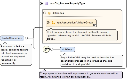
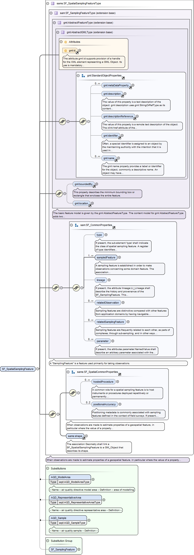
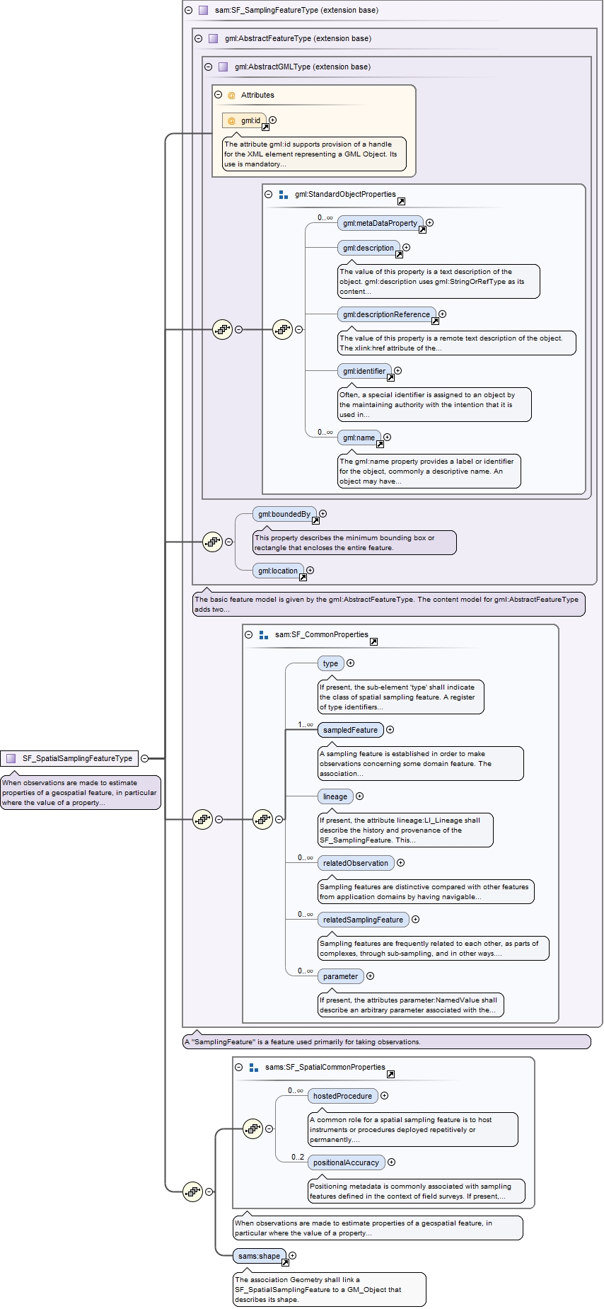
A common role for a spatial sampling feature is to hostinstruments or procedures deployed repetitively or permanently. If present,the association Platform shall link the SF_SpatialSamplingFeature to anOM_Process deployed at it. The OM_Process has the role hostedProcedure withrespect to the sampling feature.
<element name="hostedProcedure" type="om:OM_ProcessPropertyType" minOccurs="0" maxOccurs="unbounded"><annotation><documentation>A common role for a spatial sampling feature is to host instruments or procedures deployed repetitively or permanently. If present, the association Platform shall link the SF_SpatialSamplingFeature to an OM_Process deployed at it. The OM_Process has the role hostedProcedure with respect to the sampling feature.</documentation></annotation></element>
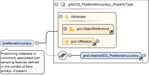
Positioning metadata is commonly associated with samplingfeatures defined in the context of field surveys. If present,positionalAccuracy:DQ_PositionalAccuracy shall describe the accuracy of thepositioning of the sampling feature. Up to two instances of the attributesupport the independent description of horizontal and vertical accuracy.
<element name="positionalAccuracy" type="gmd:DQ_PositionalAccuracy_PropertyType" minOccurs="0" maxOccurs="2"><annotation><documentation>Positioning metadata is commonly associated with sampling features defined in the context of field surveys. If present, positionalAccuracy:DQ_PositionalAccuracy shall describe the accuracy of the positioning of the sampling feature. Up to two instances of the attribute support the independent description of horizontal and vertical accuracy.</documentation></annotation></element>
The attribute gml:id supports provision of a handle for the XML element representing a GML Object. Its use is mandatory for all GML objects. It is of XML type ID, so is constrained to be unique in the XML document within which it occurs.
When observations are made to estimate properties of a geospatialfeature, in particular where the value of a property varies within the scope of thefeature, a spatial sampling feature is used. Depending on accessibility and on thenature of the expected property variation, the sampling feature may be extensive inone, two or three spatial dimensions. Processing and visualization methods are oftendependent on the topological dimension of the sampling manifold, so this provides anatural classification system for sampling features. This classification followscommon practice in focussing on conventional spatial dimensions. Properties observedon sampling features may be time-dependent, but the temporal axis does not generallycontribute to the classification of sampling feature classes. Sampling featureidentity is usually less time-dependent than is the property value.
The attribute gml:id supports provision of a handle for the XML element representing a GML Object. Its use is mandatory for all GML objects. It is of XML type ID, so is constrained to be unique in the XML document within which it occurs.
Source
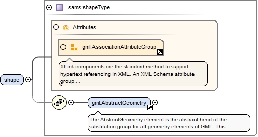
<complexType name="SF_SpatialSamplingFeatureType"><annotation><documentation>When observations are made to estimate properties of a geospatial feature, in particular where the value of a property varies within the scope of the feature, a spatial sampling feature is used. Depending on accessibility and on the nature of the expected property variation, the sampling feature may be extensive in one, two or three spatial dimensions. Processing and visualization methods are often dependent on the topological dimension of the sampling manifold, so this provides a natural classification system for sampling features. This classification follows common practice in focussing on conventional spatial dimensions. Properties observed on sampling features may be time-dependent, but the temporal axis does not generally contribute to the classification of sampling feature classes. Sampling feature identity is usually less time-dependent than is the property value.</documentation></annotation><complexContent><extension base="sam:SF_SamplingFeatureType"><sequence><group ref="sams:SF_SpatialCommonProperties"/><element ref="sams:shape"><annotation><documentation>The association Geometry shall link a SF_SpatialSamplingFeature to a GM_Object that describes its shape.</documentation></annotation></element></sequence></extension></complexContent></complexType>
When observations are made to estimate properties of a geospatialfeature, in particular where the value of a property varies within the scope of thefeature, a spatial sampling feature is used. Depending on accessibility and on thenature of the expected property variation, the sampling feature may be extensive inone, two or three spatial dimensions. Processing and visualization methods are oftendependent on the topological dimension of the sampling manifold, so this provides anatural classification system for sampling features. This classification followscommon practice in focussing on conventional spatial dimensions. Properties observedon sampling features may be time-dependent, but the temporal axis does not generallycontribute to the classification of sampling feature classes. Sampling featureidentity is usually less time-dependent than is the property value.
<group name="SF_SpatialCommonProperties"><annotation><documentation>When observations are made to estimate properties of a geospatial feature, in particular where the value of a property varies within the scope of the feature, a spatial sampling feature is used. Depending on accessibility and on the nature of the expected property variation, the sampling feature may be extensive in one, two or three spatial dimensions. Processing and visualization methods are often dependent on the topological dimension of the sampling manifold, so this provides a natural classification system for sampling features. This classification follows common practice in focussing on conventional spatial dimensions. Properties observed on sampling features may be time-dependent, but the temporal axis does not generally contribute to the classification of sampling feature classes. Sampling feature identity is usually less time-dependent than is the property value.</documentation></annotation><sequence><element name="hostedProcedure" type="om:OM_ProcessPropertyType" minOccurs="0" maxOccurs="unbounded"><annotation><documentation>A common role for a spatial sampling feature is to host instruments or procedures deployed repetitively or permanently. If present, the association Platform shall link the SF_SpatialSamplingFeature to an OM_Process deployed at it. The OM_Process has the role hostedProcedure with respect to the sampling feature.</documentation></annotation></element><element name="positionalAccuracy" type="gmd:DQ_PositionalAccuracy_PropertyType" minOccurs="0" maxOccurs="2"><annotation><documentation>Positioning metadata is commonly associated with sampling features defined in the context of field surveys. If present, positionalAccuracy:DQ_PositionalAccuracy shall describe the accuracy of the positioning of the sampling feature. Up to two instances of the attribute support the independent description of horizontal and vertical accuracy.</documentation></annotation></element></sequence></group>